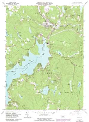
Hawley Topo Map Pennsylvania
To zoom in, hover over the map of Hawley
USGS Topo Quad 41075d2 - 1:24,000 scale
| Topo Map Name: | Hawley |
| USGS Topo Quad ID: | 41075d2 |
| Print Size: | ca. 21 1/4" wide x 27" high |
| Southeast Coordinates: | 41.375° N latitude / 75.125° W longitude |
| Map Center Coordinates: | 41.4375° N latitude / 75.1875° W longitude |
| U.S. State: | PA |
| Filename: | o41075d2.jpg |
| Download Map JPG Image: | Hawley topo map 1:24,000 scale |
| Map Type: | Topographic |
| Topo Series: | 7.5´ |
| Map Scale: | 1:24,000 |
| Source of Map Images: | United States Geological Survey (USGS) |
| Alternate Map Versions: |
Hawley PA 1966, updated 1967 Download PDF Buy paper map Hawley PA 1966, updated 1974 Download PDF Buy paper map Hawley PA 1966, updated 1983 Download PDF Buy paper map Hawley PA 1994, updated 1995 Download PDF Buy paper map Hawley PA 1997, updated 2000 Download PDF Buy paper map Hawley PA 2010 Download PDF Buy paper map Hawley PA 2013 Download PDF Buy paper map Hawley PA 2016 Download PDF Buy paper map |
1:24,000 Topo Quads surrounding Hawley
> Back to 41075a1 at 1:100,000 scale
> Back to 41074a1 at 1:250,000 scale
> Back to U.S. Topo Maps home
Hawley topo map: Gazetteer
Hawley: Airports
Port Florence Airport elevation 439m 1440′Tanglwood Ski Area Airport elevation 441m 1446′
Hawley: Capes
Spinnler Point elevation 379m 1243′Hawley: Dams
Buehler Dam elevation 409m 1341′Debris Dam Number One elevation 280m 918′
Debris Dam Number Two elevation 282m 925′
Decker Swamp Dam elevation 323m 1059′
Deckers Dam elevation 390m 1279′
Fairview Lake Dam elevation 465m 1525′
Hawley Water Company Dam elevation 351m 1151′
House Pond Dam elevation 372m 1220′
Kelly Lake Dam elevation 387m 1269′
Lake Florence Dam elevation 384m 1259′
Lake Wallenpaupack Dam elevation 321m 1053′
Lambert Dam elevation 304m 997′
Power Dam elevation 401m 1315′
Seely Dam elevation 366m 1200′
Tinkwig Dam elevation 340m 1115′
Ungers Dam elevation 392m 1286′
Valley View Dam elevation 316m 1036′
Wallenpaupack Dam elevation 361m 1184′
Wangaum Falls Dam elevation 325m 1066′
Whitney Lake Dam elevation 417m 1368′
Whitneys Lake Dam elevation 418m 1371′
Hawley: Falls
Wangum Falls elevation 331m 1085′Hawley: Flats
Gates Meadow elevation 449m 1473′Hawley: Islands
Epply Island elevation 374m 1227′Hawley: Lakes
Mainses Pond elevation 465m 1525′White Deer Lake elevation 451m 1479′
Hawley: Levees
Tafton Dike elevation 361m 1184′Hawley: Parks
State Game Lands Number 183 elevation 289m 948′Hawley: Populated Places
Hawley elevation 276m 905′Melchris Wood elevation 452m 1482′
Paupack elevation 477m 1564′
Tafton elevation 467m 1532′
Tanglewood elevation 419m 1374′
Uswick elevation 443m 1453′
Wangaum elevation 335m 1099′
West Hawley elevation 293m 961′
Wilsonville elevation 366m 1200′
Hawley: Reservoirs
Buehler Lake elevation 409m 1341′Decker Pond elevation 321m 1053′
Fairview Lake elevation 464m 1522′
Florence Lake elevation 387m 1269′
House Pond elevation 371m 1217′
Lake Wallenpaupack elevation 361m 1184′
Murray Pond elevation 387m 1269′
Robinson Lake elevation 441m 1446′
Tinkwig Lake elevation 335m 1099′
Ungers Lake elevation 392m 1286′
Valley View Lake elevation 316m 1036′
Wangum Lake elevation 320m 1049′
Whitney Lake elevation 417m 1368′
Hawley: Streams
Diamond Creek elevation 365m 1197′Gates Run elevation 425m 1394′
Middle Creek elevation 272m 892′
Mill Brook elevation 365m 1197′
Red Shale Brook elevation 312m 1023′
Sand Spring Creek elevation 391m 1282′
Seeley Brook elevation 365m 1197′
Sheridan Brook elevation 365m 1197′
Spinner Brook elevation 366m 1200′
Swamp Brook elevation 261m 856′
Swan Creek elevation 366m 1200′
Tinkwig Creek elevation 259m 849′
Wangum Creek elevation 316m 1036′
Hawley: Summits
Big Hill elevation 531m 1742′Buckhorn Mountain elevation 429m 1407′
Gates Hill elevation 514m 1686′
Hawley: Swamps
Cattail Swamp elevation 401m 1315′Hawley: Trails
Blooming Grove Trail elevation 450m 1476′White Deer Trail elevation 457m 1499′
Hawley digital topo map on disk
Buy this Hawley topo map showing relief, roads, GPS coordinates and other geographical features, as a high-resolution digital map file on DVD:
New York, Vermont, Connecticut & Western Massachusetts
Buy digital topo maps: New York, Vermont, Connecticut & Western Massachusetts


