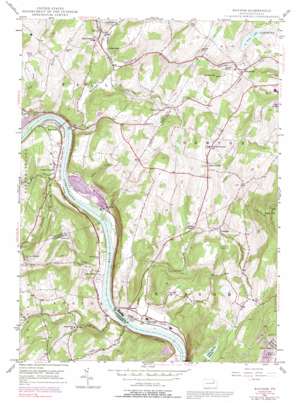
Ransom Topo Map Pennsylvania
To zoom in, hover over the map of Ransom
USGS Topo Quad 41075d7 - 1:24,000 scale
| Topo Map Name: | Ransom |
| USGS Topo Quad ID: | 41075d7 |
| Print Size: | ca. 21 1/4" wide x 27" high |
| Southeast Coordinates: | 41.375° N latitude / 75.75° W longitude |
| Map Center Coordinates: | 41.4375° N latitude / 75.8125° W longitude |
| U.S. State: | PA |
| Filename: | o41075d7.jpg |
| Download Map JPG Image: | Ransom topo map 1:24,000 scale |
| Map Type: | Topographic |
| Topo Series: | 7.5´ |
| Map Scale: | 1:24,000 |
| Source of Map Images: | United States Geological Survey (USGS) |
| Alternate Map Versions: |
Ransom PA 1946, updated 1964 Download PDF Buy paper map Ransom PA 1946, updated 1969 Download PDF Buy paper map Ransom PA 1946, updated 1978 Download PDF Buy paper map Ransom PA 1946, updated 1991 Download PDF Buy paper map Ransom PA 1949 Download PDF Buy paper map Ransom PA 1994, updated 1995 Download PDF Buy paper map Ransom PA 2010 Download PDF Buy paper map Ransom PA 2013 Download PDF Buy paper map Ransom PA 2016 Download PDF Buy paper map |
1:24,000 Topo Quads surrounding Ransom
> Back to 41075a1 at 1:100,000 scale
> Back to 41074a1 at 1:250,000 scale
> Back to U.S. Topo Maps home
Ransom topo map: Gazetteer
Ransom: Airports
Scranton Municipal Airport elevation 351m 1151′Ransom: Dams
Cobbs Lake Dam elevation 341m 1118′Falling Springs Dam elevation 387m 1269′
Fords Lake Dam elevation 348m 1141′
Ransom: Falls
Buttermilk Falls elevation 190m 623′Ransom: Lakes
Joslyn Pond elevation 295m 967′Ransom: Populated Places
Falls elevation 185m 606′Mill City elevation 261m 856′
Milwaukee elevation 282m 925′
Newton Center elevation 359m 1177′
Ransom elevation 190m 623′
Schultzville elevation 342m 1122′
Shaffers Corners elevation 291m 954′
Upper Exeter elevation 181m 593′
West Falls elevation 179m 587′
Wyoanna elevation 182m 597′
Ransom: Reservoirs
Falling Springs Reservoir elevation 411m 1348′Fords Lake elevation 347m 1138′
Mack Lake elevation 341m 1118′
Ransom: Streams
Beaver Creek elevation 232m 761′Buttermilk Creek elevation 171m 561′
Cider Run elevation 266m 872′
Dymond Creek elevation 166m 544′
Falls Creek elevation 229m 751′
Fitch Creek elevation 165m 541′
Gardner Creek elevation 165m 541′
Keeler Creek elevation 165m 541′
Lewis Creek elevation 170m 557′
Mill Creek elevation 180m 590′
Sutton Creek elevation 168m 551′
Whitelock Creek elevation 169m 554′
Ransom: Summits
Griffin Hill elevation 390m 1279′Pinnacle Rock elevation 681m 2234′
Pinnacle Rock elevation 685m 2247′
Square Top elevation 355m 1164′
Ransom: Trails
Pinnacle Trail elevation 476m 1561′Ransom digital topo map on disk
Buy this Ransom topo map showing relief, roads, GPS coordinates and other geographical features, as a high-resolution digital map file on DVD:
New York, Vermont, Connecticut & Western Massachusetts
Buy digital topo maps: New York, Vermont, Connecticut & Western Massachusetts


