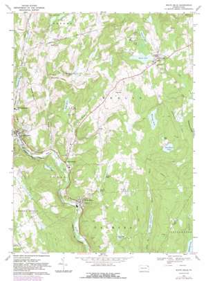
White Mills Topo Map Pennsylvania
To zoom in, hover over the map of White Mills
USGS Topo Quad 41075e2 - 1:24,000 scale
| Topo Map Name: | White Mills |
| USGS Topo Quad ID: | 41075e2 |
| Print Size: | ca. 21 1/4" wide x 27" high |
| Southeast Coordinates: | 41.5° N latitude / 75.125° W longitude |
| Map Center Coordinates: | 41.5625° N latitude / 75.1875° W longitude |
| U.S. State: | PA |
| Filename: | o41075e2.jpg |
| Download Map JPG Image: | White Mills topo map 1:24,000 scale |
| Map Type: | Topographic |
| Topo Series: | 7.5´ |
| Map Scale: | 1:24,000 |
| Source of Map Images: | United States Geological Survey (USGS) |
| Alternate Map Versions: |
White Mills PA 1967, updated 1970 Download PDF Buy paper map White Mills PA 1967, updated 1974 Download PDF Buy paper map White Mills PA 1967, updated 1983 Download PDF Buy paper map White Mills PA 1967, updated 1983 Download PDF Buy paper map White Mills PA 1999, updated 2001 Download PDF Buy paper map White Mills PA 2010 Download PDF Buy paper map White Mills PA 2013 Download PDF Buy paper map White Mills PA 2016 Download PDF Buy paper map |
1:24,000 Topo Quads surrounding White Mills
> Back to 41075e1 at 1:100,000 scale
> Back to 41074a1 at 1:250,000 scale
> Back to U.S. Topo Maps home
White Mills topo map: Gazetteer
White Mills: Airports
Cherry Ridge Airport elevation 406m 1332′Schneiders Field elevation 421m 1381′
White Mills: Dams
Bayly Pond Dam elevation 423m 1387′Brown Dam elevation 392m 1286′
Bunnells Pond Dam elevation 328m 1076′
Constance Dam elevation 323m 1059′
Freethy Dam elevation 336m 1102′
Lower Wilcox Pond Dam elevation 399m 1309′
Open Woods Pond Dam elevation 360m 1181′
Pa-413 Dam elevation 358m 1174′
Pa-415 Dam elevation 388m 1272′
Pa-416 Dam elevation 405m 1328′
Pa-419 Dam elevation 383m 1256′
Pa-420 Dam elevation 392m 1286′
Pa-421 Dam elevation 389m 1276′
Quarno Dam elevation 365m 1197′
Suydam Dam elevation 394m 1292′
Syndam Dam elevation 395m 1295′
Trimpi Pond Dam elevation 324m 1062′
Trout Lake Dam elevation 380m 1246′
Williams Pond Dam elevation 384m 1259′
White Mills: Lakes
Huff Pond elevation 367m 1204′White Mills: Populated Places
Beach Lake elevation 400m 1312′Bethel elevation 362m 1187′
East Honesdale elevation 294m 964′
Indian Orchard elevation 295m 967′
Laurella elevation 365m 1197′
White Mills elevation 286m 938′
White Mills: Reservoirs
Beach Lake elevation 396m 1299′Bucks Cove Lake elevation 331m 1085′
Bunnells Pond elevation 328m 1076′
Butcher Pond elevation 380m 1246′
Chestnut Lake elevation 394m 1292′
Freethy Pond elevation 336m 1102′
Lake Constance elevation 324m 1062′
Long Ridge Pond elevation 387m 1269′
Lower Wilcox Pond elevation 399m 1309′
Mud Pond elevation 365m 1197′
Open Woods Pond elevation 363m 1190′
Pa-420 Reservoir elevation 392m 1286′
Suydam Pond elevation 398m 1305′
Williams Pond elevation 386m 1266′
White Mills: Streams
Carley Brook elevation 292m 958′Holbert Creek elevation 285m 935′
Indian Orchard Brook elevation 283m 928′
Rocky Run elevation 316m 1036′
White Mills: Summits
Smith Hill elevation 432m 1417′Vine Hill elevation 463m 1519′
White Mills digital topo map on disk
Buy this White Mills topo map showing relief, roads, GPS coordinates and other geographical features, as a high-resolution digital map file on DVD:
New York, Vermont, Connecticut & Western Massachusetts
Buy digital topo maps: New York, Vermont, Connecticut & Western Massachusetts


