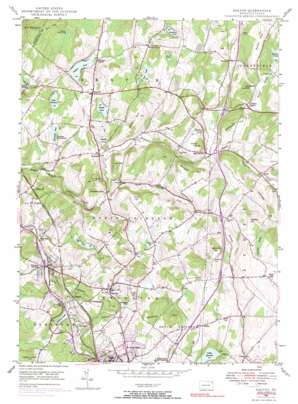
Dalton Topo Map Pennsylvania
To zoom in, hover over the map of Dalton
USGS Topo Quad 41075e6 - 1:24,000 scale
| Topo Map Name: | Dalton |
| USGS Topo Quad ID: | 41075e6 |
| Print Size: | ca. 21 1/4" wide x 27" high |
| Southeast Coordinates: | 41.5° N latitude / 75.625° W longitude |
| Map Center Coordinates: | 41.5625° N latitude / 75.6875° W longitude |
| U.S. State: | PA |
| Filename: | o41075e6.jpg |
| Download Map JPG Image: | Dalton topo map 1:24,000 scale |
| Map Type: | Topographic |
| Topo Series: | 7.5´ |
| Map Scale: | 1:24,000 |
| Source of Map Images: | United States Geological Survey (USGS) |
| Alternate Map Versions: |
Dalton PA 1946, updated 1958 Download PDF Buy paper map Dalton PA 1946, updated 1966 Download PDF Buy paper map Dalton PA 1946, updated 1971 Download PDF Buy paper map Dalton PA 1946, updated 1971 Download PDF Buy paper map Dalton PA 1946, updated 1991 Download PDF Buy paper map Dalton PA 1949 Download PDF Buy paper map Dalton PA 1994, updated 1995 Download PDF Buy paper map Dalton PA 2010 Download PDF Buy paper map Dalton PA 2013 Download PDF Buy paper map Dalton PA 2016 Download PDF Buy paper map |
1:24,000 Topo Quads surrounding Dalton
> Back to 41075e1 at 1:100,000 scale
> Back to 41074a1 at 1:250,000 scale
> Back to U.S. Topo Maps home
Dalton topo map: Gazetteer
Dalton: Airports
Endless Mountains Airport elevation 377m 1236′Grayce Farms Airport elevation 403m 1322′
Dalton: Dams
Basset Dam elevation 368m 1207′Baylors Lake Dam elevation 353m 1158′
Glenburn Dam elevation 314m 1030′
Lackawanna Dam elevation 345m 1131′
Sickler Dam elevation 365m 1197′
Dalton: Lakes
Bassett Pond elevation 361m 1184′Baylors Mud Pond elevation 349m 1145′
Deer Lake elevation 384m 1259′
Handsome Pond elevation 403m 1322′
Lilly Lake elevation 339m 1112′
Manataka Lake elevation 356m 1167′
Mud Pond elevation 390m 1279′
Stevenson Pond elevation 363m 1190′
Trostle Pond elevation 317m 1040′
Dalton: Parks
Lackawanna State Park elevation 346m 1135′Dalton: Populated Places
Carpenter Town elevation 299m 980′Craig elevation 346m 1135′
Dalton elevation 296m 971′
East Benton elevation 328m 1076′
Edella elevation 481m 1578′
Fleetville elevation 381m 1250′
Glenburn elevation 355m 1164′
Humphreysville elevation 320m 1049′
Justus elevation 449m 1473′
Scott elevation 349m 1145′
Wallsville elevation 325m 1066′
Waverly elevation 391m 1282′
Dalton: Reservoirs
Baylors Pond elevation 346m 1135′Cordner Pond elevation 374m 1227′
Duck Pond elevation 379m 1243′
Glenburn Pond elevation 311m 1020′
Lackawanna Lake elevation 345m 1131′
Lake Kewanee elevation 364m 1194′
Sicklers Pond elevation 354m 1161′
Dalton: Streams
Ackerly Creek elevation 316m 1036′Kennedy Creek elevation 299m 980′
Dalton: Summits
Bull Hill elevation 381m 1250′Bushkos Hill elevation 417m 1368′
Captain White Hill elevation 422m 1384′
Carpenter Hill elevation 493m 1617′
Church Hill elevation 399m 1309′
Davidson Hill elevation 428m 1404′
Dry Hill elevation 397m 1302′
Fairground Hill elevation 385m 1263′
Kennedy Hill elevation 451m 1479′
Lee Hill elevation 358m 1174′
Newton Hill elevation 514m 1686′
Sarnoski Hill elevation 407m 1335′
Supko Hill elevation 445m 1459′
Turkey Hill elevation 386m 1266′
Weatherby Hill elevation 481m 1578′
Dalton: Swamps
Carpenter Swamp elevation 484m 1587′Dalton: Valleys
Smith Valley elevation 338m 1108′Dalton digital topo map on disk
Buy this Dalton topo map showing relief, roads, GPS coordinates and other geographical features, as a high-resolution digital map file on DVD:
New York, Vermont, Connecticut & Western Massachusetts
Buy digital topo maps: New York, Vermont, Connecticut & Western Massachusetts


