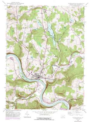
Tunkhannock Topo Map Pennsylvania
To zoom in, hover over the map of Tunkhannock
USGS Topo Quad 41075e8 - 1:24,000 scale
| Topo Map Name: | Tunkhannock |
| USGS Topo Quad ID: | 41075e8 |
| Print Size: | ca. 21 1/4" wide x 27" high |
| Southeast Coordinates: | 41.5° N latitude / 75.875° W longitude |
| Map Center Coordinates: | 41.5625° N latitude / 75.9375° W longitude |
| U.S. State: | PA |
| Filename: | o41075e8.jpg |
| Download Map JPG Image: | Tunkhannock topo map 1:24,000 scale |
| Map Type: | Topographic |
| Topo Series: | 7.5´ |
| Map Scale: | 1:24,000 |
| Source of Map Images: | United States Geological Survey (USGS) |
| Alternate Map Versions: |
Tunkhannock PA 1946, updated 1971 Download PDF Buy paper map Tunkhannock PA 1946, updated 1977 Download PDF Buy paper map Tunkhannock PA 1946, updated 1984 Download PDF Buy paper map Tunkhannock PA 1948 Download PDF Buy paper map Tunkhannock PA 1948 Download PDF Buy paper map Tunkhannock PA 2000, updated 2001 Download PDF Buy paper map Tunkhannock PA 2010 Download PDF Buy paper map Tunkhannock PA 2013 Download PDF Buy paper map Tunkhannock PA 2016 Download PDF Buy paper map |
1:24,000 Topo Quads surrounding Tunkhannock
> Back to 41075e1 at 1:100,000 scale
> Back to 41074a1 at 1:250,000 scale
> Back to U.S. Topo Maps home
Tunkhannock topo map: Gazetteer
Tunkhannock: Airports
C J K Airport elevation 331m 1085′Skyhaven Airport elevation 195m 639′
Tunkhannock: Basins
Kern Glen elevation 258m 846′Tunkhannock: Dams
Lake Carey Dam elevation 303m 994′Stevens Lake Dam elevation 338m 1108′
Tunkhannock: Islands
First Island elevation 200m 656′La Grange Island elevation 166m 544′
Second Island elevation 189m 620′
Third Island elevation 184m 603′
Tunkhannock: Lakes
Bartron Pond elevation 358m 1174′Creamery Pond elevation 322m 1056′
Cruver Pond elevation 338m 1108′
Lake Carey elevation 290m 951′
Oxbow Lake elevation 326m 1069′
Racavitch Pond elevation 324m 1062′
Tunkhannock: Populated Places
Aldovin elevation 325m 1066′Brookside elevation 325m 1066′
Cooper Corners elevation 302m 990′
Dixon elevation 217m 711′
Eatonville elevation 187m 613′
Kaiserville elevation 257m 843′
Lake Carey elevation 293m 961′
Lemon elevation 335m 1099′
Marcy elevation 285m 935′
Osterhout elevation 192m 629′
Rosengrant elevation 203m 666′
Tunkhannock elevation 194m 636′
Tunkhannock: Post Offices
Lake Carey Post Office (historical) elevation 293m 961′Tunkhannock: Reservoirs
Fish Pond Dam elevation 338m 1108′Mud Pond elevation 322m 1056′
Tunkhannock: Streams
Billings Mill Brook elevation 187m 613′Bowman Creek elevation 171m 561′
Horton Creek elevation 268m 879′
Jackson Creek elevation 174m 570′
Kern Glen Creek elevation 225m 738′
Meade Brook elevation 298m 977′
Mill Run elevation 172m 564′
Oxbow Inlet elevation 320m 1049′
Sugar Hollow Creek elevation 197m 646′
Swale Brook elevation 186m 610′
Taques Creek elevation 177m 580′
Tunkhannock Creek elevation 177m 580′
Tunkhannock: Summits
Avery Mountain elevation 425m 1394′Cedar Ledge elevation 409m 1341′
German Hill elevation 352m 1154′
Kintner Hill elevation 396m 1299′
Mount Airy elevation 417m 1368′
Oak Hill elevation 419m 1374′
Osterhout Mountain elevation 589m 1932′
Prospect Hill elevation 462m 1515′
Shupp Hill elevation 371m 1217′
Valentine Hill elevation 428m 1404′
Vargo Hill elevation 389m 1276′
Yahmer Hill elevation 435m 1427′
Tunkhannock: Swamps
Gallager Swamp elevation 255m 836′Helman Swamp elevation 318m 1043′
Jenkins Swamp elevation 318m 1043′
Loomis Swamp elevation 334m 1095′
Round Swamp elevation 305m 1000′
Tunkhannock: Valleys
Benson Hollow elevation 171m 561′Sugar Hollow elevation 198m 649′
Whippoorwill Hollow elevation 270m 885′
Tunkhannock digital topo map on disk
Buy this Tunkhannock topo map showing relief, roads, GPS coordinates and other geographical features, as a high-resolution digital map file on DVD:
New York, Vermont, Connecticut & Western Massachusetts
Buy digital topo maps: New York, Vermont, Connecticut & Western Massachusetts


