Damascus Topo Map Pennsylvania
To zoom in, hover over the map of Damascus
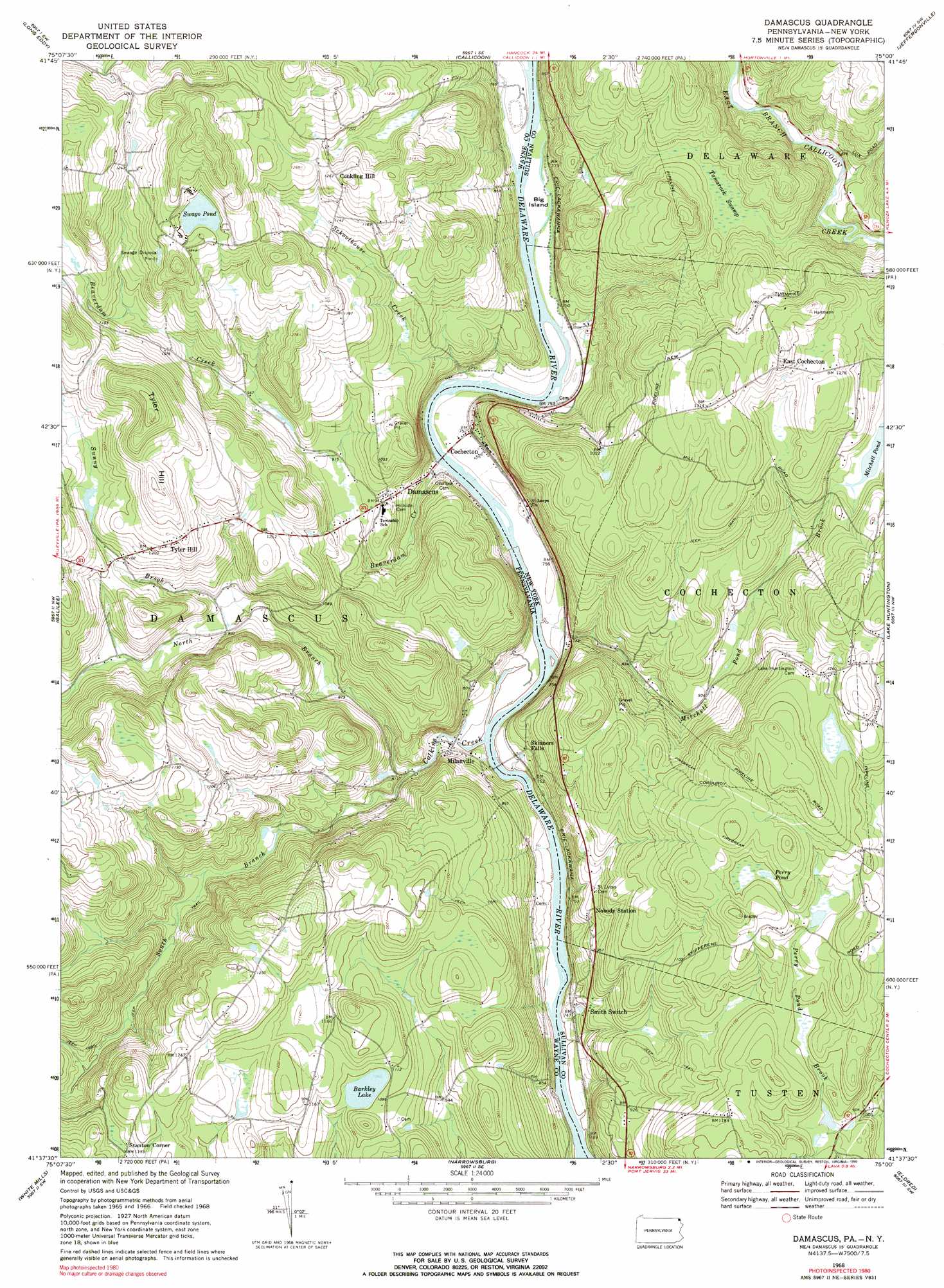
USGS Topo Quad 41075f1 - 1:24,000 scale
| Topo Map Name: | Damascus |
| USGS Topo Quad ID: | 41075f1 |
| Print Size: | ca. 21 1/4" wide x 27" high |
| Southeast Coordinates: | 41.625° N latitude / 75° W longitude |
| Map Center Coordinates: | 41.6875° N latitude / 75.0625° W longitude |
| U.S. States: | PA, NY |
| Filename: | o41075f1.jpg |
| Download Map JPG Image: | Damascus topo map 1:24,000 scale |
| Map Type: | Topographic |
| Topo Series: | 7.5´ |
| Map Scale: | 1:24,000 |
| Source of Map Images: | United States Geological Survey (USGS) |
| Alternate Map Versions: |
Damascus PA 1968, updated 1970 Download PDF Buy paper map Damascus PA 1968, updated 1990 Download PDF Buy paper map Damascus PA 1993, updated 1995 Download PDF Buy paper map Damascus PA 2010 Download PDF Buy paper map Damascus PA 2013 Download PDF Buy paper map Damascus PA 2016 Download PDF Buy paper map |
1:24,000 Topo Quads surrounding Damascus
Hancock |
Fishs Eddy |
Horton |
Roscoe |
Livingston Manor |
Lake Como |
Long Eddy |
Callicoon |
Jeffersonville |
Liberty West |
Aldenville |
Galilee |
Damascus |
Lake Huntington |
White Lake |
Honesdale |
White Mills |
Narrowsburg |
Eldred |
Highland Lake |
Lakeville |
Hawley |
Rowland |
Shohola |
Pond Eddy |
> Back to 41075e1 at 1:100,000 scale
> Back to 41074a1 at 1:250,000 scale
> Back to U.S. Topo Maps home
Damascus topo map: Gazetteer
Damascus: Airports
Campis Airport elevation 346m 1135′Damascus: Dams
Upper Tyler Hill Dam elevation 329m 1079′Damascus: Islands
Big Island elevation 221m 725′Damascus: Lakes
Barkley Lake elevation 330m 1082′Mitchell Pond elevation 322m 1056′
Perry Pond elevation 363m 1190′
Swago Pond elevation 395m 1295′
Damascus: Parks
Upper Delaware Scenic and Recreation River elevation 300m 984′Damascus: Populated Places
Cochecton elevation 225m 738′Conklin Hill elevation 384m 1259′
Damascus elevation 220m 721′
East Cochecton elevation 400m 1312′
Milanville elevation 229m 751′
Stanton Corner elevation 345m 1131′
Tyler Hill elevation 375m 1230′
Damascus: Streams
Beaverdam Creek elevation 213m 698′Calkins Creek elevation 207m 679′
Mitchell Pond Brook elevation 213m 698′
North Branch Calkins Creek elevation 224m 734′
Schoolhouse Creek elevation 213m 698′
South Branch Calkins Creek elevation 224m 734′
Sunny Brook elevation 276m 905′
Damascus: Summits
Tyler Hill elevation 469m 1538′Damascus: Swamps
Tamarack Swamp elevation 326m 1069′Damascus digital topo map on disk
Buy this Damascus topo map showing relief, roads, GPS coordinates and other geographical features, as a high-resolution digital map file on DVD:
New York, Vermont, Connecticut & Western Massachusetts
Buy digital topo maps: New York, Vermont, Connecticut & Western Massachusetts