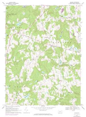
Galilee Topo Map Pennsylvania
To zoom in, hover over the map of Galilee
USGS Topo Quad 41075f2 - 1:24,000 scale
| Topo Map Name: | Galilee |
| USGS Topo Quad ID: | 41075f2 |
| Print Size: | ca. 21 1/4" wide x 27" high |
| Southeast Coordinates: | 41.625° N latitude / 75.125° W longitude |
| Map Center Coordinates: | 41.6875° N latitude / 75.1875° W longitude |
| U.S. State: | PA |
| Filename: | o41075f2.jpg |
| Download Map JPG Image: | Galilee topo map 1:24,000 scale |
| Map Type: | Topographic |
| Topo Series: | 7.5´ |
| Map Scale: | 1:24,000 |
| Source of Map Images: | United States Geological Survey (USGS) |
| Alternate Map Versions: |
Galilee PA 1967, updated 1970 Download PDF Buy paper map Galilee PA 1967, updated 1974 Download PDF Buy paper map Galilee PA 1992, updated 1995 Download PDF Buy paper map Galilee PA 2010 Download PDF Buy paper map Galilee PA 2013 Download PDF Buy paper map Galilee PA 2016 Download PDF Buy paper map |
1:24,000 Topo Quads surrounding Galilee
> Back to 41075e1 at 1:100,000 scale
> Back to 41074a1 at 1:250,000 scale
> Back to U.S. Topo Maps home
Galilee topo map: Gazetteer
Galilee: Dams
Alder Marsh Dam elevation 457m 1499′Barnes Dam elevation 419m 1374′
Brussell and Brunner Dam elevation 397m 1302′
Kellow Lake Dam elevation 439m 1440′
Lovelass Dam elevation 357m 1171′
Miller Pond Dam elevation 504m 1653′
Galilee: Lakes
Cline Pond elevation 417m 1368′Day Pond elevation 440m 1443′
Galilee Pond elevation 379m 1243′
Lovelace Pond elevation 454m 1489′
Rose Pond elevation 466m 1528′
Silver Lake elevation 401m 1315′
Sky Lake elevation 417m 1368′
Galilee: Populated Places
Boyds Mills elevation 337m 1105′Calkins elevation 412m 1351′
Carley Brook elevation 359m 1177′
Fallsdale elevation 365m 1197′
Galilee elevation 360m 1181′
Girdland elevation 488m 1601′
Rileyville elevation 490m 1607′
Rutledgedale elevation 408m 1338′
Torrey elevation 448m 1469′
West Damascus elevation 391m 1282′
Galilee: Reservoirs
Beaver Lake elevation 392m 1286′Brussell and Brunner Reservoir elevation 397m 1302′
Fallsdale Pond elevation 357m 1171′
Laurel Lake elevation 384m 1259′
Miller Pond elevation 504m 1653′
Upper Wilcox Pond elevation 435m 1427′
Galilee digital topo map on disk
Buy this Galilee topo map showing relief, roads, GPS coordinates and other geographical features, as a high-resolution digital map file on DVD:
New York, Vermont, Connecticut & Western Massachusetts
Buy digital topo maps: New York, Vermont, Connecticut & Western Massachusetts


