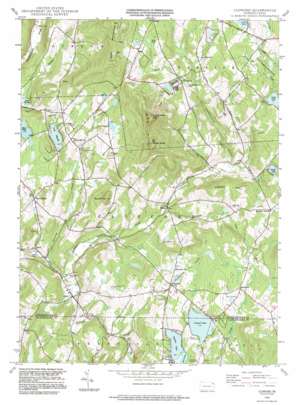
Clifford Topo Map Pennsylvania
To zoom in, hover over the map of Clifford
USGS Topo Quad 41075f5 - 1:24,000 scale
| Topo Map Name: | Clifford |
| USGS Topo Quad ID: | 41075f5 |
| Print Size: | ca. 21 1/4" wide x 27" high |
| Southeast Coordinates: | 41.625° N latitude / 75.5° W longitude |
| Map Center Coordinates: | 41.6875° N latitude / 75.5625° W longitude |
| U.S. State: | PA |
| Filename: | o41075f5.jpg |
| Download Map JPG Image: | Clifford topo map 1:24,000 scale |
| Map Type: | Topographic |
| Topo Series: | 7.5´ |
| Map Scale: | 1:24,000 |
| Source of Map Images: | United States Geological Survey (USGS) |
| Alternate Map Versions: |
Clifford PA 1946, updated 1971 Download PDF Buy paper map Clifford PA 1946, updated 1983 Download PDF Buy paper map Clifford PA 1948, updated 1948 Download PDF Buy paper map Clifford PA 1949 Download PDF Buy paper map Clifford PA 1949, updated 1949 Download PDF Buy paper map Clifford PA 1994, updated 1995 Download PDF Buy paper map Clifford PA 2010 Download PDF Buy paper map Clifford PA 2013 Download PDF Buy paper map Clifford PA 2016 Download PDF Buy paper map |
1:24,000 Topo Quads surrounding Clifford
> Back to 41075e1 at 1:100,000 scale
> Back to 41074a1 at 1:250,000 scale
> Back to U.S. Topo Maps home
Clifford topo map: Gazetteer
Clifford: Airports
Carbondale-Clifford Airport elevation 419m 1374′Cosklos Elkview Airport elevation 493m 1617′
Malinchak Airport elevation 509m 1669′
Clifford: Dams
Coterell Lake Dam elevation 513m 1683′Ross Dam elevation 555m 1820′
Clifford: Lakes
Coterell Lake elevation 500m 1640′Lake Idlewild elevation 385m 1263′
Mud Pond elevation 416m 1364′
Mud Pond elevation 503m 1650′
Newton Lake elevation 500m 1640′
Clifford: Populated Places
Birchtown elevation 545m 1788′Clifford elevation 324m 1062′
Dundaff elevation 490m 1607′
Elkdale elevation 373m 1223′
Royal elevation 315m 1033′
West Clifford elevation 381m 1250′
Clifford: Reservoirs
Crystal Lake elevation 530m 1738′Ross Lake elevation 555m 1820′
Clifford: Streams
Dundaff Creek elevation 315m 1033′Idlewild Creek elevation 310m 1017′
Little Creek elevation 397m 1302′
Tinker Creek elevation 364m 1194′
Clifford: Summits
East Mountain elevation 719m 2358′Elk Hill elevation 748m 2454′
North Knob elevation 817m 2680′
Round Hill elevation 540m 1771′
South Knob elevation 792m 2598′
Tinker Hill elevation 534m 1751′
Clifford: Swamps
Bear Swamp elevation 345m 1131′Clifford: Valleys
Tinker Hollow elevation 413m 1354′Clifford digital topo map on disk
Buy this Clifford topo map showing relief, roads, GPS coordinates and other geographical features, as a high-resolution digital map file on DVD:
New York, Vermont, Connecticut & Western Massachusetts
Buy digital topo maps: New York, Vermont, Connecticut & Western Massachusetts


