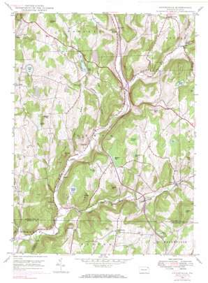
Lenoxville Topo Map Pennsylvania
To zoom in, hover over the map of Lenoxville
USGS Topo Quad 41075f6 - 1:24,000 scale
| Topo Map Name: | Lenoxville |
| USGS Topo Quad ID: | 41075f6 |
| Print Size: | ca. 21 1/4" wide x 27" high |
| Southeast Coordinates: | 41.625° N latitude / 75.625° W longitude |
| Map Center Coordinates: | 41.6875° N latitude / 75.6875° W longitude |
| U.S. State: | PA |
| Filename: | o41075f6.jpg |
| Download Map JPG Image: | Lenoxville topo map 1:24,000 scale |
| Map Type: | Topographic |
| Topo Series: | 7.5´ |
| Map Scale: | 1:24,000 |
| Source of Map Images: | United States Geological Survey (USGS) |
| Alternate Map Versions: |
Lenoxville PA 1946, updated 1971 Download PDF Buy paper map Lenoxville PA 1946, updated 1984 Download PDF Buy paper map Lenoxville PA 1946, updated 1984 Download PDF Buy paper map Lenoxville PA 1949 Download PDF Buy paper map Lenoxville PA 1999, updated 2001 Download PDF Buy paper map Lenoxville PA 1999, updated 2001 Download PDF Buy paper map Lenoxville PA 2010 Download PDF Buy paper map Lenoxville PA 2013 Download PDF Buy paper map Lenoxville PA 2016 Download PDF Buy paper map |
1:24,000 Topo Quads surrounding Lenoxville
> Back to 41075e1 at 1:100,000 scale
> Back to 41074a1 at 1:250,000 scale
> Back to U.S. Topo Maps home
Lenoxville topo map: Gazetteer
Lenoxville: Dams
Acre Pond Dam elevation 361m 1184′Horton Lake Dam elevation 380m 1246′
Jeffers Pond Dam elevation 447m 1466′
Lenoxville: Lakes
Acre Pond elevation 368m 1207′Finn Pond elevation 375m 1230′
Harding Pond elevation 370m 1213′
Hartley Pond elevation 337m 1105′
Loomis Lake elevation 396m 1299′
Robinson Lake elevation 366m 1200′
Round Pond elevation 397m 1302′
Tea Pond elevation 378m 1240′
Lenoxville: Populated Places
East Lenox elevation 429m 1407′Glenwood elevation 236m 774′
Lenox elevation 270m 885′
Lenoxville elevation 305m 1000′
Marshbrook elevation 371m 1217′
South Gibson elevation 304m 997′
West Lenox elevation 372m 1220′
Lenoxville: Reservoirs
Horton Lake elevation 380m 1246′Jeffers Pond elevation 336m 1102′
Lenoxville: Ridges
Hickory Ridge elevation 358m 1174′Lenoxville: Streams
Bear Swamp Creek elevation 287m 941′Bell Creek elevation 288m 944′
Butler Creek elevation 272m 892′
East Branch Tunkhannock Creek elevation 233m 764′
Millard Creek elevation 236m 774′
Nine Partners Creek elevation 265m 869′
Partners Creek elevation 250m 820′
Sterling Brook elevation 317m 1040′
Tower Branch elevation 246m 807′
Willow Brook elevation 244m 800′
Lenoxville: Summits
Carey Hill elevation 498m 1633′Cobble Hill elevation 405m 1328′
Finn Hill elevation 457m 1499′
Gunn Hill elevation 460m 1509′
Hartley Hill elevation 398m 1305′
Jeffers Hill elevation 421m 1381′
Morgan Hill elevation 495m 1624′
Oak Knob elevation 388m 1272′
Pine Hill elevation 380m 1246′
Thorn Hill elevation 552m 1811′
Lenoxville: Swamps
Tamarack Swamp elevation 381m 1250′Lenoxville: Valleys
Pratt Hollow elevation 245m 803′Lenoxville digital topo map on disk
Buy this Lenoxville topo map showing relief, roads, GPS coordinates and other geographical features, as a high-resolution digital map file on DVD:
New York, Vermont, Connecticut & Western Massachusetts
Buy digital topo maps: New York, Vermont, Connecticut & Western Massachusetts


