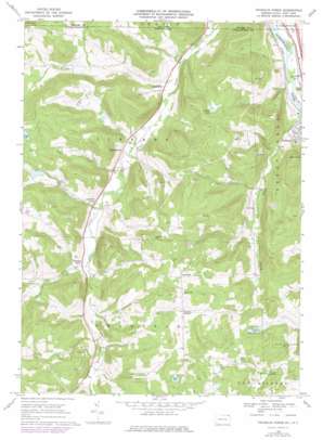
Franklin Forks Topo Map Pennsylvania
To zoom in, hover over the map of Franklin Forks
USGS Topo Quad 41075h7 - 1:24,000 scale
| Topo Map Name: | Franklin Forks |
| USGS Topo Quad ID: | 41075h7 |
| Print Size: | ca. 21 1/4" wide x 27" high |
| Southeast Coordinates: | 41.875° N latitude / 75.75° W longitude |
| Map Center Coordinates: | 41.9375° N latitude / 75.8125° W longitude |
| U.S. States: | PA, NY |
| Filename: | o41075h7.jpg |
| Download Map JPG Image: | Franklin Forks topo map 1:24,000 scale |
| Map Type: | Topographic |
| Topo Series: | 7.5´ |
| Map Scale: | 1:24,000 |
| Source of Map Images: | United States Geological Survey (USGS) |
| Alternate Map Versions: |
Franklin Forks PA 1968, updated 1971 Download PDF Buy paper map Franklin Forks PA 1968, updated 1976 Download PDF Buy paper map Franklin Forks PA 1968, updated 1978 Download PDF Buy paper map Franklin Forks PA 1992, updated 1995 Download PDF Buy paper map Franklin Forks PA 2010 Download PDF Buy paper map Franklin Forks PA 2013 Download PDF Buy paper map Franklin Forks PA 2016 Download PDF Buy paper map |
1:24,000 Topo Quads surrounding Franklin Forks
> Back to 41075e1 at 1:100,000 scale
> Back to 41074a1 at 1:250,000 scale
> Back to U.S. Topo Maps home
Franklin Forks topo map: Gazetteer
Franklin Forks: Dams
Bel-Air Lake Dam elevation 435m 1427′DuBois Creek Dam elevation 331m 1085′
Mingo Lake Dam elevation 454m 1489′
Oteyokwa Lake Dam elevation 476m 1561′
Franklin Forks: Lakes
Lake Roy elevation 488m 1601′Oteyokwa Lake elevation 470m 1541′
Tripp Lake elevation 494m 1620′
Franklin Forks: Parks
Salt Springs State Park elevation 369m 1210′Franklin Forks: Populated Places
Blue Ridge Mobile Home Park elevation 291m 954′Brookdale elevation 292m 958′
Franklin Forks elevation 332m 1089′
Lawsville Center elevation 332m 1089′
Stanfordville elevation 316m 1036′
Upsonville elevation 502m 1646′
Franklin Forks: Reservoirs
Bel-Air Lake elevation 435m 1427′Darrow Pond elevation 494m 1620′
DuBois Reservoir elevation 331m 1085′
Mingo Lake elevation 452m 1482′
Rose Pond elevation 458m 1502′
Franklin Forks: Springs
Salt Springs elevation 378m 1240′Franklin Forks: Streams
Fall Brook elevation 343m 1125′Jones Creek elevation 304m 997′
Rhiney Creek elevation 286m 938′
Silver Creek elevation 331m 1085′
Trowbridge Creek elevation 261m 856′
Trowbridge Creek elevation 261m 856′
Franklin Forks: Summits
Roundtop elevation 482m 1581′Stonecrop Hill elevation 549m 1801′
Franklin Forks digital topo map on disk
Buy this Franklin Forks topo map showing relief, roads, GPS coordinates and other geographical features, as a high-resolution digital map file on DVD:
New York, Vermont, Connecticut & Western Massachusetts
Buy digital topo maps: New York, Vermont, Connecticut & Western Massachusetts


