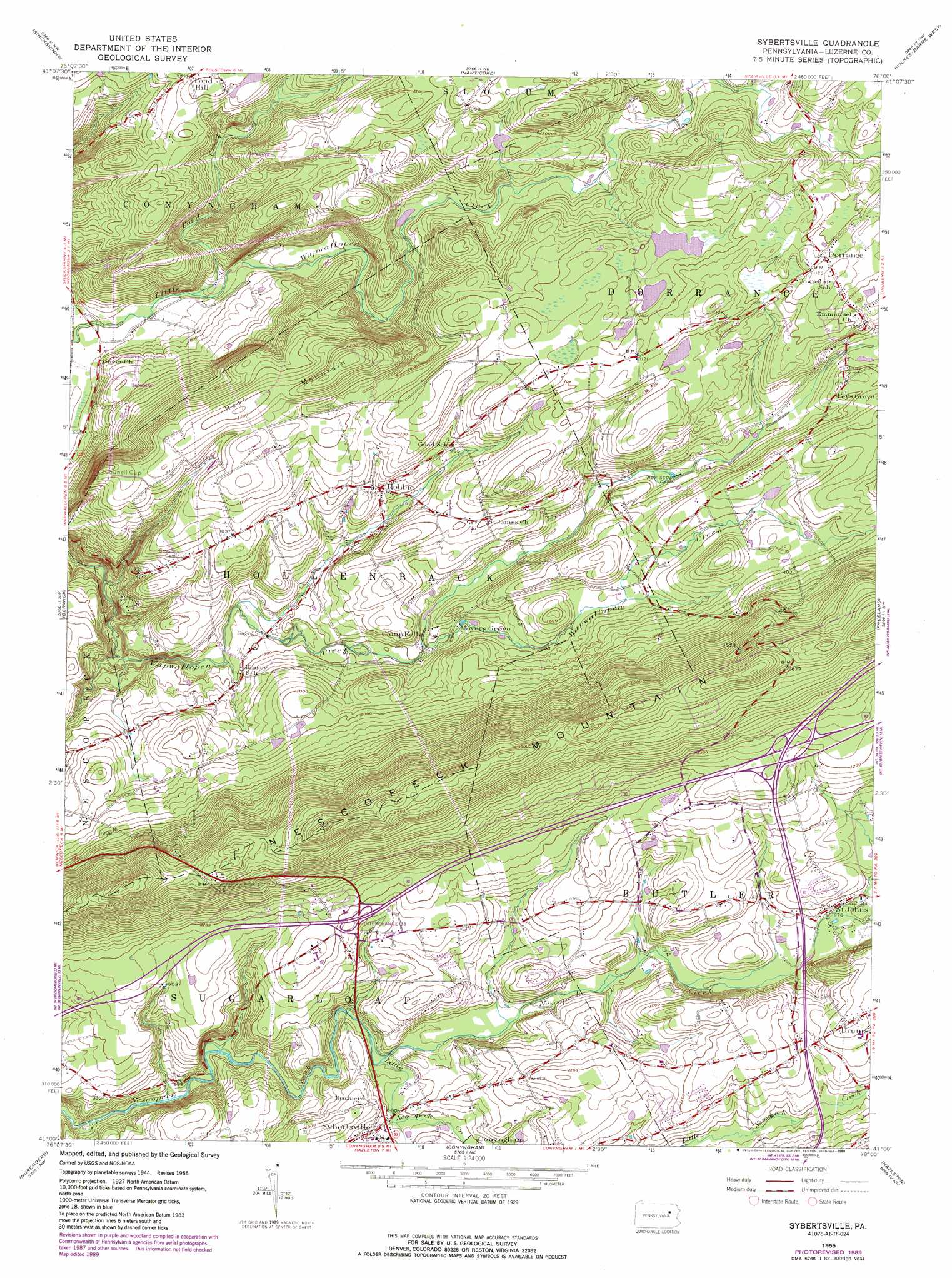
Sybertsville Topo Map Pennsylvania
To zoom in, hover over the map of Sybertsville
USGS Topo Quad 41076a1 - 1:24,000 scale
| Topo Map Name: | Sybertsville |
| USGS Topo Quad ID: | 41076a1 |
| Print Size: | ca. 21 1/4" wide x 27" high |
| Southeast Coordinates: | 41° N latitude / 76° W longitude |
| Map Center Coordinates: | 41.0625° N latitude / 76.0625° W longitude |
| U.S. State: | PA |
| Filename: | o41076a1.jpg |
| Download Map JPG Image: | Sybertsville topo map 1:24,000 scale |
| Map Type: | Topographic |
| Topo Series: | 7.5´ |
| Map Scale: | 1:24,000 |
| Source of Map Images: | United States Geological Survey (USGS) |
| Alternate Map Versions: |
Sybertsville PA 1955, updated 1957 Download PDF Buy paper map Sybertsville PA 1955, updated 1969 Download PDF Buy paper map Sybertsville PA 1955, updated 1978 Download PDF Buy paper map Sybertsville PA 1955, updated 1989 Download PDF Buy paper map Sybertsville PA 1976, updated 1979 Download PDF Buy paper map Sybertsville PA 2010 Download PDF Buy paper map Sybertsville PA 2013 Download PDF Buy paper map Sybertsville PA 2016 Download PDF Buy paper map |
1:24,000 Topo Quads surrounding Sybertsville
Red Rock |
Sweet Valley |
Harveys Lake |
Kingston |
Pittston |
Stillwater |
Shickshinny |
Nanticoke |
Wilkes-Barre West |
Wilkes-Barre East |
Mifflinville |
Berwick |
Sybertsville |
Freeland |
White Haven |
Shumans |
Nuremberg |
Conyngham |
Hazleton |
Weatherly |
Ashland |
Shenandoah |
Delano |
Tamaqua |
Nesquehoning |
> Back to 41076a1 at 1:100,000 scale
> Back to 41076a1 at 1:250,000 scale
> Back to U.S. Topo Maps home
Sybertsville topo map: Gazetteer
Sybertsville: Airports
Clarks Hill Airport elevation 350m 1148′Sybertsville: Populated Places
Dorrance elevation 343m 1125′Feys Grove elevation 309m 1013′
Hobbie elevation 284m 931′
Moyers Grove elevation 250m 820′
Saint Johns elevation 296m 971′
Scanlin elevation 248m 813′
Sybertsville elevation 274m 898′
Sybertsville: Streams
Balliet Run elevation 244m 800′Kester Creek elevation 230m 754′
Little Nescopeck Creek elevation 262m 859′
Long Run elevation 292m 958′
Pond Creek elevation 159m 521′
Sybertsville: Summits
Council Cup elevation 372m 1220′Hess Mountain elevation 388m 1272′
Sybertsville digital topo map on disk
Buy this Sybertsville topo map showing relief, roads, GPS coordinates and other geographical features, as a high-resolution digital map file on DVD:
New York, Vermont, Connecticut & Western Massachusetts
Buy digital topo maps: New York, Vermont, Connecticut & Western Massachusetts