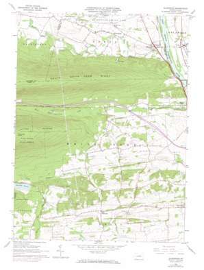
Allenwood Topo Map Pennsylvania
To zoom in, hover over the map of Allenwood
USGS Topo Quad 41076a8 - 1:24,000 scale
| Topo Map Name: | Allenwood |
| USGS Topo Quad ID: | 41076a8 |
| Print Size: | ca. 21 1/4" wide x 27" high |
| Southeast Coordinates: | 41° N latitude / 76.875° W longitude |
| Map Center Coordinates: | 41.0625° N latitude / 76.9375° W longitude |
| U.S. State: | PA |
| Filename: | o41076a8.jpg |
| Download Map JPG Image: | Allenwood topo map 1:24,000 scale |
| Map Type: | Topographic |
| Topo Series: | 7.5´ |
| Map Scale: | 1:24,000 |
| Source of Map Images: | United States Geological Survey (USGS) |
| Alternate Map Versions: |
Allenwood PA 1965, updated 1967 Download PDF Buy paper map Allenwood PA 1965, updated 1973 Download PDF Buy paper map Allenwood PA 1965, updated 1973 Download PDF Buy paper map Allenwood PA 2010 Download PDF Buy paper map Allenwood PA 2013 Download PDF Buy paper map Allenwood PA 2016 Download PDF Buy paper map |
1:24,000 Topo Quads surrounding Allenwood
> Back to 41076a1 at 1:100,000 scale
> Back to 41076a1 at 1:250,000 scale
> Back to U.S. Topo Maps home
Allenwood topo map: Gazetteer
Allenwood: Dams
Spruce Reservoir Dam elevation 206m 675′White Deer Dam elevation 208m 682′
Allenwood: Populated Places
Allenwood elevation 147m 482′Dewart elevation 148m 485′
Kelly Crossroads elevation 160m 524′
Old Furnace elevation 183m 600′
Spring Garden elevation 145m 475′
Allenwood: Reservoirs
Spruce Run Reservoir elevation 206m 675′Allenwood: Streams
Delaware Run elevation 138m 452′Dry Run elevation 138m 452′
Spring Creek elevation 142m 465′
White Deer Hole Creek elevation 137m 449′
Allenwood: Summits
Catharines Crown elevation 588m 1929′Allenwood digital topo map on disk
Buy this Allenwood topo map showing relief, roads, GPS coordinates and other geographical features, as a high-resolution digital map file on DVD:
New York, Vermont, Connecticut & Western Massachusetts
Buy digital topo maps: New York, Vermont, Connecticut & Western Massachusetts


