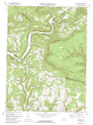
Sonestown Topo Map Pennsylvania
To zoom in, hover over the map of Sonestown
USGS Topo Quad 41076c5 - 1:24,000 scale
| Topo Map Name: | Sonestown |
| USGS Topo Quad ID: | 41076c5 |
| Print Size: | ca. 21 1/4" wide x 27" high |
| Southeast Coordinates: | 41.25° N latitude / 76.5° W longitude |
| Map Center Coordinates: | 41.3125° N latitude / 76.5625° W longitude |
| U.S. State: | PA |
| Filename: | o41076c5.jpg |
| Download Map JPG Image: | Sonestown topo map 1:24,000 scale |
| Map Type: | Topographic |
| Topo Series: | 7.5´ |
| Map Scale: | 1:24,000 |
| Source of Map Images: | United States Geological Survey (USGS) |
| Alternate Map Versions: |
Sonestown PA 1970, updated 1973 Download PDF Buy paper map Sonestown PA 1970, updated 1989 Download PDF Buy paper map Sonestown PA 1970, updated 1989 Download PDF Buy paper map Sonestown PA 1999, updated 2001 Download PDF Buy paper map Sonestown PA 2010 Download PDF Buy paper map Sonestown PA 2013 Download PDF Buy paper map Sonestown PA 2016 Download PDF Buy paper map |
1:24,000 Topo Quads surrounding Sonestown
> Back to 41076a1 at 1:100,000 scale
> Back to 41076a1 at 1:250,000 scale
> Back to U.S. Topo Maps home
Sonestown topo map: Gazetteer
Sonestown: Dams
Beaver Lake Dam elevation 286m 938′Sonestown: Lakes
Beaver Lake elevation 276m 905′Sonestown: Parks
State Game Lands Number 13 elevation 674m 2211′Sonestown: Populated Places
Beaver Lake elevation 275m 902′Beech Glen elevation 254m 833′
Biggerstown elevation 301m 987′
Lungerville elevation 428m 1404′
Muncy Valley elevation 265m 869′
North Mountain elevation 403m 1322′
Sonestown elevation 293m 961′
Strawbridge elevation 329m 1079′
Sonestown: Reservoirs
Beaver Lake elevation 286m 938′Sonestown: Streams
Big Run elevation 292m 958′Buck Run elevation 334m 1095′
Bully Run elevation 407m 1335′
Deep Hollow Run elevation 346m 1135′
Hemlock Run elevation 558m 1830′
Marsh Run elevation 260m 853′
Mosey Run elevation 304m 997′
Slip Run elevation 317m 1040′
Slip Run elevation 591m 1938′
Spring Run elevation 231m 757′
Swanks Run elevation 604m 1981′
The Outlet elevation 371m 1217′
Trout Run elevation 257m 843′
West Branch Little Muncy Creek elevation 296m 971′
West Creek elevation 334m 1095′
Sonestown: Summits
Bad Hill elevation 363m 1190′Sonestown digital topo map on disk
Buy this Sonestown topo map showing relief, roads, GPS coordinates and other geographical features, as a high-resolution digital map file on DVD:
New York, Vermont, Connecticut & Western Massachusetts
Buy digital topo maps: New York, Vermont, Connecticut & Western Massachusetts


