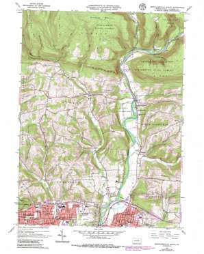
Montoursville North Topo Map Pennsylvania
To zoom in, hover over the map of Montoursville North
USGS Topo Quad 41076c8 - 1:24,000 scale
| Topo Map Name: | Montoursville North |
| USGS Topo Quad ID: | 41076c8 |
| Print Size: | ca. 21 1/4" wide x 27" high |
| Southeast Coordinates: | 41.25° N latitude / 76.875° W longitude |
| Map Center Coordinates: | 41.3125° N latitude / 76.9375° W longitude |
| U.S. State: | PA |
| Filename: | o41076c8.jpg |
| Download Map JPG Image: | Montoursville North topo map 1:24,000 scale |
| Map Type: | Topographic |
| Topo Series: | 7.5´ |
| Map Scale: | 1:24,000 |
| Source of Map Images: | United States Geological Survey (USGS) |
| Alternate Map Versions: |
Montoursville North PA 1965, updated 1967 Download PDF Buy paper map Montoursville North PA 1965, updated 1974 Download PDF Buy paper map Montoursville North PA 1965, updated 1986 Download PDF Buy paper map Montoursville North PA 1965, updated 1986 Download PDF Buy paper map Montoursville North PA 1999, updated 2001 Download PDF Buy paper map Montoursville North PA 2010 Download PDF Buy paper map Montoursville North PA 2013 Download PDF Buy paper map Montoursville North PA 2016 Download PDF Buy paper map |
1:24,000 Topo Quads surrounding Montoursville North
> Back to 41076a1 at 1:100,000 scale
> Back to 41076a1 at 1:250,000 scale
> Back to U.S. Topo Maps home
Montoursville North topo map: Gazetteer
Montoursville North: Parks
Loyalsock State Game Farm elevation 180m 590′State Game Lands Number 298 elevation 533m 1748′
Montoursville North: Populated Places
Butternut Grove elevation 208m 682′Farragut elevation 185m 606′
Kenmar elevation 168m 551′
Loyalsockville elevation 193m 633′
Montoursville elevation 164m 538′
North Eldred elevation 262m 859′
Penn Vale elevation 169m 554′
Warrensville elevation 219m 718′
Montoursville North: Streams
Butternut Grove Run elevation 192m 629′Calebs Run elevation 234m 767′
Dry Run elevation 197m 646′
Lick Run elevation 185m 606′
Martins Run elevation 285m 935′
Mill Creek elevation 162m 531′
Mill Creek elevation 162m 531′
Sugarcamp Run elevation 262m 859′
Wallis Run elevation 189m 620′
Montoursville North: Summits
Mill Creek Mountain elevation 586m 1922′Quaker Hill elevation 319m 1046′
Scofield Mountain elevation 366m 1200′
The Wells Mountain elevation 590m 1935′
Montoursville North: Trails
Red Bank Trail elevation 512m 1679′Riffle Trail elevation 434m 1423′
Montoursville North: Valleys
Crooked Riffles Hollow elevation 199m 652′Greens Hollow elevation 180m 590′
Jacoby Hollow elevation 216m 708′
Kaiser Hollow elevation 205m 672′
Montoursville North digital topo map on disk
Buy this Montoursville North topo map showing relief, roads, GPS coordinates and other geographical features, as a high-resolution digital map file on DVD:
New York, Vermont, Connecticut & Western Massachusetts
Buy digital topo maps: New York, Vermont, Connecticut & Western Massachusetts


