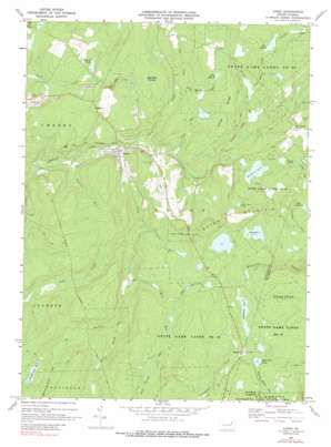
Lopez Topo Map Pennsylvania
To zoom in, hover over the map of Lopez
USGS Topo Quad 41076d3 - 1:24,000 scale
| Topo Map Name: | Lopez |
| USGS Topo Quad ID: | 41076d3 |
| Print Size: | ca. 21 1/4" wide x 27" high |
| Southeast Coordinates: | 41.375° N latitude / 76.25° W longitude |
| Map Center Coordinates: | 41.4375° N latitude / 76.3125° W longitude |
| U.S. State: | PA |
| Filename: | o41076d3.jpg |
| Download Map JPG Image: | Lopez topo map 1:24,000 scale |
| Map Type: | Topographic |
| Topo Series: | 7.5´ |
| Map Scale: | 1:24,000 |
| Source of Map Images: | United States Geological Survey (USGS) |
| Alternate Map Versions: |
Lopez PA 1969, updated 1973 Download PDF Buy paper map Lopez PA 1969, updated 1977 Download PDF Buy paper map Lopez PA 1969, updated 1988 Download PDF Buy paper map Lopez PA 1969, updated 1991 Download PDF Buy paper map Lopez PA 1969, updated 1991 Download PDF Buy paper map Lopez PA 2010 Download PDF Buy paper map Lopez PA 2013 Download PDF Buy paper map Lopez PA 2016 Download PDF Buy paper map |
1:24,000 Topo Quads surrounding Lopez
> Back to 41076a1 at 1:100,000 scale
> Back to 41076a1 at 1:250,000 scale
> Back to U.S. Topo Maps home
Lopez topo map: Gazetteer
Lopez: Dams
Connell Dam elevation 578m 1896′Creveling Lake Dam elevation 636m 2086′
Lake John Dam elevation 624m 2047′
Splash Dam elevation 616m 2020′
Lopez: Lakes
Pine Marsh elevation 634m 2080′Rouse Pond elevation 628m 2060′
Ryman Pond elevation 575m 1886′
Shumans Lake elevation 561m 1840′
Lopez: Parks
State Game Lands Number 57 elevation 651m 2135′State Game Lands Number 66 elevation 621m 2037′
Lopez: Populated Places
Lopez elevation 525m 1722′McCarroll Corner elevation 619m 2030′
Murray elevation 596m 1955′
Ricketts elevation 633m 2076′
Lopez: Reservoirs
Connell Pond elevation 577m 1893′Creveling Lake elevation 636m 2086′
Lake John elevation 624m 2047′
Little Rouse Pond elevation 607m 1991′
Painter Den Pond elevation 701m 2299′
Splashdam Pond elevation 616m 2020′
Wild Fowl Pond elevation 634m 2080′
Lopez: Ridges
Indian Ridge elevation 640m 2099′Lopez: Streams
Bear Swamp Run elevation 639m 2096′Cabin Run elevation 553m 1814′
Cherry Ridge Run elevation 621m 2037′
Cold Run elevation 564m 1850′
Flag Marsh Run elevation 571m 1873′
Long Run elevation 540m 1771′
Lopez Creek elevation 525m 1722′
Noon Run elevation 581m 1906′
Open Run elevation 619m 2030′
Painter Den Creek elevation 554m 1817′
Pigeon Creek elevation 527m 1729′
Pine Marsh Creek elevation 635m 2083′
Rocky Run elevation 564m 1850′
Santee Creek elevation 552m 1811′
Sherman Run elevation 514m 1686′
Spring Brook elevation 624m 2047′
Wolf Run elevation 585m 1919′
Yellow Run elevation 582m 1909′
Lopez: Summits
High Cobble elevation 651m 2135′Lopez: Swamps
Flag Marsh elevation 646m 2119′Half Moon Swamp elevation 622m 2040′
Lopez: Valleys
Snorting Buck Hollow elevation 664m 2178′Lopez digital topo map on disk
Buy this Lopez topo map showing relief, roads, GPS coordinates and other geographical features, as a high-resolution digital map file on DVD:
New York, Vermont, Connecticut & Western Massachusetts
Buy digital topo maps: New York, Vermont, Connecticut & Western Massachusetts


