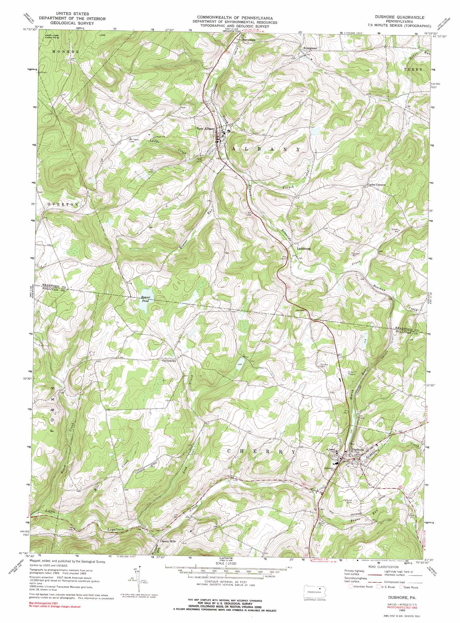
Dushore Topo Map Pennsylvania
To zoom in, hover over the map of Dushore
USGS Topo Quad 41076e4 - 1:24,000 scale
| Topo Map Name: | Dushore |
| USGS Topo Quad ID: | 41076e4 |
| Print Size: | ca. 21 1/4" wide x 27" high |
| Southeast Coordinates: | 41.5° N latitude / 76.375° W longitude |
| Map Center Coordinates: | 41.5625° N latitude / 76.4375° W longitude |
| U.S. State: | PA |
| Filename: | o41076e4.jpg |
| Download Map JPG Image: | Dushore topo map 1:24,000 scale |
| Map Type: | Topographic |
| Topo Series: | 7.5´ |
| Map Scale: | 1:24,000 |
| Source of Map Images: | United States Geological Survey (USGS) |
| Alternate Map Versions: |
Dushore PA 1969, updated 1973 Download PDF Buy paper map Dushore PA 1969, updated 1977 Download PDF Buy paper map Dushore PA 1969, updated 1991 Download PDF Buy paper map Dushore PA 2010 Download PDF Buy paper map Dushore PA 2013 Download PDF Buy paper map Dushore PA 2016 Download PDF Buy paper map |
1:24,000 Topo Quads surrounding Dushore
East Troy |
Ulster |
Towanda |
Rome |
Le Raysville |
Leroy |
Powell |
Monroeton |
Wyalusing |
Laceyville |
Shunk |
Overton |
Dushore |
Colley |
Jenningsville |
Hillsgrove |
Eagles Mere |
Laporte |
Lopez |
Dutch Mountain |
Picture Rocks |
Sonestown |
Elk Grove |
Red Rock |
Sweet Valley |
> Back to 41076e1 at 1:100,000 scale
> Back to 41076a1 at 1:250,000 scale
> Back to U.S. Topo Maps home
Dushore topo map: Gazetteer
Dushore: Airports
Meehan Airport elevation 520m 1706′Dushore: Lakes
Beaver Pond elevation 506m 1660′Dushore: Populated Places
Cherry Mills elevation 408m 1338′Coveytown elevation 498m 1633′
Dushore elevation 443m 1453′
Evergreen elevation 417m 1368′
Laddsburg elevation 404m 1325′
New Albany elevation 370m 1213′
Stevenson elevation 356m 1167′
Dushore: Reservoirs
Bob Kosts Pond elevation 439m 1440′Dushore: Streams
Beaver Run elevation 367m 1204′Black Creek elevation 364m 1194′
Bowman Creek elevation 405m 1328′
French Creek elevation 379m 1243′
Ladds Creek elevation 373m 1223′
Lick Creek elevation 390m 1279′
Marsh Run elevation 438m 1437′
Mill Creek elevation 368m 1207′
Payne Run elevation 431m 1414′
Wampole Run elevation 395m 1295′
Dushore digital topo map on disk
Buy this Dushore topo map showing relief, roads, GPS coordinates and other geographical features, as a high-resolution digital map file on DVD:
New York, Vermont, Connecticut & Western Massachusetts
Buy digital topo maps: New York, Vermont, Connecticut & Western Massachusetts