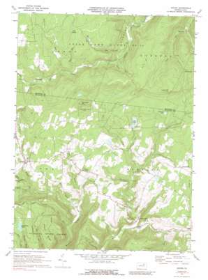
Shunk Topo Map Pennsylvania
To zoom in, hover over the map of Shunk
USGS Topo Quad 41076e6 - 1:24,000 scale
| Topo Map Name: | Shunk |
| USGS Topo Quad ID: | 41076e6 |
| Print Size: | ca. 21 1/4" wide x 27" high |
| Southeast Coordinates: | 41.5° N latitude / 76.625° W longitude |
| Map Center Coordinates: | 41.5625° N latitude / 76.6875° W longitude |
| U.S. State: | PA |
| Filename: | o41076e6.jpg |
| Download Map JPG Image: | Shunk topo map 1:24,000 scale |
| Map Type: | Topographic |
| Topo Series: | 7.5´ |
| Map Scale: | 1:24,000 |
| Source of Map Images: | United States Geological Survey (USGS) |
| Alternate Map Versions: |
Shunk PA 1970, updated 1973 Download PDF Buy paper map Shunk PA 1970, updated 1977 Download PDF Buy paper map Shunk PA 1970, updated 1989 Download PDF Buy paper map Shunk PA 1995, updated 1999 Download PDF Buy paper map Shunk PA 2010 Download PDF Buy paper map Shunk PA 2013 Download PDF Buy paper map Shunk PA 2016 Download PDF Buy paper map |
1:24,000 Topo Quads surrounding Shunk
> Back to 41076e1 at 1:100,000 scale
> Back to 41076a1 at 1:250,000 scale
> Back to U.S. Topo Maps home
Shunk topo map: Gazetteer
Shunk: Falls
Buttermilk Falls elevation 443m 1453′Lincoln Falls elevation 334m 1095′
Shunk: Forests
Loyalsock State Forest elevation 538m 1765′Wyoming State Forest (historical) elevation 538m 1765′
Shunk: Lakes
Bearwallow Pond elevation 549m 1801′Elk Lake elevation 482m 1581′
Williams Lake elevation 529m 1735′
Shunk: Parks
State Game Lands Number 12 elevation 622m 2040′Shunk: Populated Places
Cold Spring elevation 527m 1729′Eldredsville elevation 513m 1683′
Lincoln Falls elevation 327m 1072′
Minerville elevation 424m 1391′
Piatt elevation 494m 1620′
Quinlantown elevation 543m 1781′
Shunk elevation 454m 1489′
Shunk: Ridges
Browns Ridge elevation 581m 1906′Shunk: Streams
Cabin Run elevation 461m 1512′Dry Run elevation 344m 1128′
Fall Run elevation 417m 1368′
Lake Run elevation 421m 1381′
Lick Run elevation 374m 1227′
Little Schrader Creek elevation 432m 1417′
Lye Run elevation 551m 1807′
Pine Swamp Run elevation 559m 1833′
Porter Creek elevation 358m 1174′
Rollinson Run elevation 506m 1660′
Thomas Run elevation 460m 1509′
Weed Creek elevation 406m 1332′
Wolf Run elevation 493m 1617′
Shunk: Summits
Browns Vista elevation 554m 1817′Lake Knob elevation 687m 2253′
Roundtop Mountain elevation 636m 2086′
Shunk: Swamps
Wolf Swamp elevation 631m 2070′Shunk: Trails
Hoagland Trail elevation 495m 1624′Shunk digital topo map on disk
Buy this Shunk topo map showing relief, roads, GPS coordinates and other geographical features, as a high-resolution digital map file on DVD:
New York, Vermont, Connecticut & Western Massachusetts
Buy digital topo maps: New York, Vermont, Connecticut & Western Massachusetts


