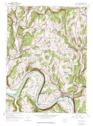
Laceyville Topo Map Pennsylvania
To zoom in, hover over the map of Laceyville
USGS Topo Quad 41076f2 - 1:24,000 scale
| Topo Map Name: | Laceyville |
| USGS Topo Quad ID: | 41076f2 |
| Print Size: | ca. 21 1/4" wide x 27" high |
| Southeast Coordinates: | 41.625° N latitude / 76.125° W longitude |
| Map Center Coordinates: | 41.6875° N latitude / 76.1875° W longitude |
| U.S. State: | PA |
| Filename: | o41076f2.jpg |
| Download Map JPG Image: | Laceyville topo map 1:24,000 scale |
| Map Type: | Topographic |
| Topo Series: | 7.5´ |
| Map Scale: | 1:24,000 |
| Source of Map Images: | United States Geological Survey (USGS) |
| Alternate Map Versions: |
Laceyville PA 1945, updated 1971 Download PDF Buy paper map Laceyville PA 1945, updated 1977 Download PDF Buy paper map Laceyville PA 1947, updated 1947 Download PDF Buy paper map Laceyville PA 1947, updated 1947 Download PDF Buy paper map Laceyville PA 1998, updated 1999 Download PDF Buy paper map Laceyville PA 2010 Download PDF Buy paper map Laceyville PA 2013 Download PDF Buy paper map Laceyville PA 2016 Download PDF Buy paper map |
1:24,000 Topo Quads surrounding Laceyville
> Back to 41076e1 at 1:100,000 scale
> Back to 41076a1 at 1:250,000 scale
> Back to U.S. Topo Maps home
Laceyville topo map: Gazetteer
Laceyville: Bends
Quicks Bend elevation 227m 744′Laceyville: Dams
Chamberlain Pond Dam elevation 357m 1171′Mill Creek Dam elevation 354m 1161′
Laceyville: Flats
North Flat elevation 219m 718′Laceyville: Islands
Dodd Island elevation 189m 620′Laceyville: Lakes
Ackley Pond elevation 406m 1332′Beaver Meadow Pond elevation 372m 1220′
Brown Pond elevation 320m 1049′
McCloe Pond elevation 330m 1082′
Sturdevant Pond elevation 367m 1204′
Tewksbury Pond elevation 387m 1269′
Laceyville: Populated Places
Browntown elevation 208m 682′Camptown elevation 230m 754′
Laceyville elevation 211m 692′
Merryall elevation 220m 721′
Rocky Forest elevation 214m 702′
Silvara elevation 252m 826′
Skinners Eddy elevation 196m 643′
Spring Hill elevation 392m 1286′
Sugar Run elevation 220m 721′
Laceyville: Reservoirs
Chamberlain Lake elevation 357m 1171′Mill Creek Reservoir elevation 354m 1161′
Laceyville: Streams
Bennet Creek elevation 248m 813′Billings Creek elevation 220m 721′
Camps Creek elevation 220m 721′
Cold Creek elevation 231m 757′
Dug Road Creek elevation 255m 836′
Fargo Creek elevation 211m 692′
Little Tuscarora Creek elevation 195m 639′
Mill Creek elevation 252m 826′
Patton Creek elevation 227m 744′
Rocky Forest Creek elevation 189m 620′
Sugar Run Creek elevation 194m 636′
Transue Creek elevation 209m 685′
Tuscarora Creek elevation 195m 639′
Laceyville: Summits
Browntown Mountain elevation 392m 1286′Doolittle Hill elevation 391m 1282′
Huff Hill elevation 428m 1404′
Laceyville: Swamps
Beaver Meadow Swamp elevation 374m 1227′Long Swamp elevation 342m 1122′
Snyder Swamp elevation 418m 1371′
Underhill Swamp elevation 400m 1312′
Laceyville digital topo map on disk
Buy this Laceyville topo map showing relief, roads, GPS coordinates and other geographical features, as a high-resolution digital map file on DVD:
New York, Vermont, Connecticut & Western Massachusetts
Buy digital topo maps: New York, Vermont, Connecticut & Western Massachusetts


