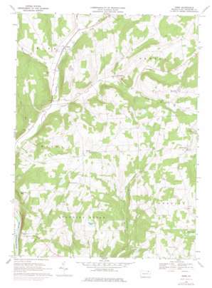
Rome Topo Map Pennsylvania
To zoom in, hover over the map of Rome
USGS Topo Quad 41076g3 - 1:24,000 scale
| Topo Map Name: | Rome |
| USGS Topo Quad ID: | 41076g3 |
| Print Size: | ca. 21 1/4" wide x 27" high |
| Southeast Coordinates: | 41.75° N latitude / 76.25° W longitude |
| Map Center Coordinates: | 41.8125° N latitude / 76.3125° W longitude |
| U.S. State: | PA |
| Filename: | o41076g3.jpg |
| Download Map JPG Image: | Rome topo map 1:24,000 scale |
| Map Type: | Topographic |
| Topo Series: | 7.5´ |
| Map Scale: | 1:24,000 |
| Source of Map Images: | United States Geological Survey (USGS) |
| Alternate Map Versions: |
Rome PA 1967, updated 1971 Download PDF Buy paper map Rome PA 1967, updated 1977 Download PDF Buy paper map Rome PA 1967, updated 1978 Download PDF Buy paper map Rome PA 2010 Download PDF Buy paper map Rome PA 2013 Download PDF Buy paper map Rome PA 2016 Download PDF Buy paper map |
1:24,000 Topo Quads surrounding Rome
> Back to 41076e1 at 1:100,000 scale
> Back to 41076a1 at 1:250,000 scale
> Back to U.S. Topo Maps home
Rome topo map: Gazetteer
Rome: Airports
Jannone-Ballibay Airport elevation 421m 1381′Sierra Ridge Airport elevation 417m 1368′
Rome: Lakes
Tamarack Pond elevation 366m 1200′Rome: Populated Places
Allis Hollow elevation 283m 928′Herrickville elevation 398m 1305′
Mercur elevation 423m 1387′
Rome elevation 249m 816′
South Hill elevation 414m 1358′
Rome: Post Offices
Herrick Post Office (historical) elevation 393m 1289′Rome: Reservoirs
Claverack Pond elevation 290m 951′Lake Bonin elevation 418m 1371′
Rome: Streams
Bear Creek elevation 249m 816′Bullard Creek elevation 243m 797′
Dry Run elevation 225m 738′
Fall Run elevation 224m 734′
Jerome Creek elevation 269m 882′
Johnson Creek elevation 231m 757′
Parks Creek elevation 254m 833′
South Creek elevation 285m 935′
Taylers Creek elevation 261m 856′
Rome: Summits
Red Rock Mountain elevation 420m 1377′Rome digital topo map on disk
Buy this Rome topo map showing relief, roads, GPS coordinates and other geographical features, as a high-resolution digital map file on DVD:
New York, Vermont, Connecticut & Western Massachusetts
Buy digital topo maps: New York, Vermont, Connecticut & Western Massachusetts


