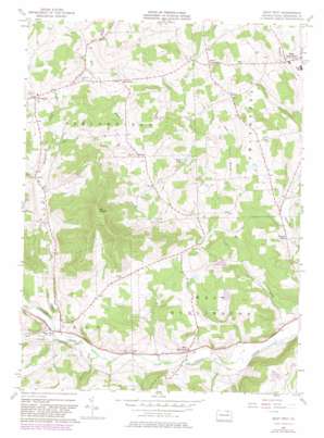
East Troy Topo Map Pennsylvania
To zoom in, hover over the map of East Troy
USGS Topo Quad 41076g6 - 1:24,000 scale
| Topo Map Name: | East Troy |
| USGS Topo Quad ID: | 41076g6 |
| Print Size: | ca. 21 1/4" wide x 27" high |
| Southeast Coordinates: | 41.75° N latitude / 76.625° W longitude |
| Map Center Coordinates: | 41.8125° N latitude / 76.6875° W longitude |
| U.S. State: | PA |
| Filename: | o41076g6.jpg |
| Download Map JPG Image: | East Troy topo map 1:24,000 scale |
| Map Type: | Topographic |
| Topo Series: | 7.5´ |
| Map Scale: | 1:24,000 |
| Source of Map Images: | United States Geological Survey (USGS) |
| Alternate Map Versions: |
East Troy PA 1957, updated 1958 Download PDF Buy paper map East Troy PA 1957, updated 1971 Download PDF Buy paper map East Troy PA 1957, updated 1981 Download PDF Buy paper map East Troy PA 2010 Download PDF Buy paper map East Troy PA 2013 Download PDF Buy paper map East Troy PA 2016 Download PDF Buy paper map |
1:24,000 Topo Quads surrounding East Troy
> Back to 41076e1 at 1:100,000 scale
> Back to 41076a1 at 1:250,000 scale
> Back to U.S. Topo Maps home
East Troy topo map: Gazetteer
East Troy: Dams
Stephen Foster Dam elevation 323m 1059′East Troy: Lakes
Pine Lake elevation 395m 1295′East Troy: Parks
Mount Pisgah State Park elevation 373m 1223′State Game Lands Number 289 elevation 390m 1279′
East Troy: Populated Places
Ayers Crossroads elevation 406m 1332′Bourne Mills elevation 306m 1003′
East Smithfield elevation 394m 1292′
East Troy elevation 297m 974′
Harkness elevation 405m 1328′
Hoblet elevation 411m 1348′
Leona elevation 353m 1158′
Springfield elevation 431m 1414′
West Burlington elevation 297m 974′
Wetona elevation 390m 1279′
East Troy: Streams
Brace Creek elevation 342m 1122′Canfield Run elevation 288m 944′
Leonard Creek elevation 298m 977′
Mud Creek elevation 292m 958′
Pisgah Creek elevation 340m 1115′
East Troy: Summits
Mount Pisgah elevation 691m 2267′East Troy digital topo map on disk
Buy this East Troy topo map showing relief, roads, GPS coordinates and other geographical features, as a high-resolution digital map file on DVD:
New York, Vermont, Connecticut & Western Massachusetts
Buy digital topo maps: New York, Vermont, Connecticut & Western Massachusetts


