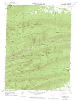
Williamsport Se Topo Map Pennsylvania
To zoom in, hover over the map of Williamsport Se
USGS Topo Quad 41077a1 - 1:24,000 scale
| Topo Map Name: | Williamsport Se |
| USGS Topo Quad ID: | 41077a1 |
| Print Size: | ca. 21 1/4" wide x 27" high |
| Southeast Coordinates: | 41° N latitude / 77° W longitude |
| Map Center Coordinates: | 41.0625° N latitude / 77.0625° W longitude |
| U.S. State: | PA |
| Filename: | o41077a1.jpg |
| Download Map JPG Image: | Williamsport Se topo map 1:24,000 scale |
| Map Type: | Topographic |
| Topo Series: | 7.5´ |
| Map Scale: | 1:24,000 |
| Source of Map Images: | United States Geological Survey (USGS) |
| Alternate Map Versions: |
Williamsport SE PA 1965, updated 1967 Download PDF Buy paper map Williamsport SE PA 1965, updated 1973 Download PDF Buy paper map Williamsport SE PA 1965, updated 1984 Download PDF Buy paper map Williamsport SE PA 2010 Download PDF Buy paper map Williamsport SE PA 2013 Download PDF Buy paper map Williamsport SE PA 2016 Download PDF Buy paper map |
1:24,000 Topo Quads surrounding Williamsport Se
> Back to 41077a1 at 1:100,000 scale
> Back to 41076a1 at 1:250,000 scale
> Back to U.S. Topo Maps home
Williamsport Se topo map: Gazetteer
Williamsport Se: Bends
Kettle Hole elevation 274m 898′Williamsport Se: Flats
Pine Flat elevation 621m 2037′Williamsport Se: Gaps
Bear Gap elevation 449m 1473′First Gap elevation 416m 1364′
Fourth Gap elevation 382m 1253′
Glen Cabin Gap elevation 424m 1391′
Kurtz Gap elevation 406m 1332′
Lyman Gap elevation 359m 1177′
Running Gap elevation 351m 1151′
Second Gap elevation 402m 1318′
Spruce Gap elevation 418m 1371′
Stony Gap elevation 418m 1371′
Third Gap elevation 377m 1236′
Williamsport Se: Ridges
Fawn Ridge elevation 557m 1827′South White Deer Ridge elevation 629m 2063′
Williamsport Se: Streams
Lick Run elevation 285m 935′Mile Run elevation 303m 994′
Sand Spring Run elevation 317m 1040′
Williamsport Se: Summits
Buffalo Mountain elevation 634m 2080′Little Mountain elevation 554m 1817′
Long Knob elevation 564m 1850′
Potato Hill elevation 553m 1814′
Round Knob elevation 533m 1748′
Shoemaker Knob elevation 557m 1827′
Williamsport Se: Trails
Bear Gap Trail elevation 483m 1584′Buck Path Trail elevation 436m 1430′
Buffalo Mountain Trail elevation 521m 1709′
Clark Trail elevation 513m 1683′
Cowbell Hollow Trail elevation 449m 1473′
Glen Cabin Trail elevation 371m 1217′
Grosses Gap Trail elevation 337m 1105′
Hoffa Trail elevation 457m 1499′
Kettle Hole Trail elevation 378m 1240′
Kurtz Gap Trail elevation 439m 1440′
Lake Trail elevation 531m 1742′
Lick Run Trail elevation 357m 1171′
Lyman Gap Trail elevation 335m 1099′
Metzger Trail elevation 397m 1302′
Mile Run Trail elevation 403m 1322′
Mud Hole Trail elevation 275m 902′
Pine Flat Trail elevation 495m 1624′
Second Gap Trail elevation 346m 1135′
Sheet Iron Trail elevation 490m 1607′
Third Gap Trail elevation 302m 990′
Top Mountain Trail elevation 560m 1837′
Webster Trail elevation 543m 1781′
Williamsport Se: Valleys
Beartrap Hollow elevation 180m 590′Cowbell Hollow elevation 339m 1112′
White Deer Valley elevation 234m 767′
Williamsport Se digital topo map on disk
Buy this Williamsport Se topo map showing relief, roads, GPS coordinates and other geographical features, as a high-resolution digital map file on DVD:
New York, Vermont, Connecticut & Western Massachusetts
Buy digital topo maps: New York, Vermont, Connecticut & Western Massachusetts


