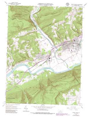
Jersey Shore Topo Map Pennsylvania
To zoom in, hover over the map of Jersey Shore
USGS Topo Quad 41077b3 - 1:24,000 scale
| Topo Map Name: | Jersey Shore |
| USGS Topo Quad ID: | 41077b3 |
| Print Size: | ca. 21 1/4" wide x 27" high |
| Southeast Coordinates: | 41.125° N latitude / 77.25° W longitude |
| Map Center Coordinates: | 41.1875° N latitude / 77.3125° W longitude |
| U.S. State: | PA |
| Filename: | o41077b3.jpg |
| Download Map JPG Image: | Jersey Shore topo map 1:24,000 scale |
| Map Type: | Topographic |
| Topo Series: | 7.5´ |
| Map Scale: | 1:24,000 |
| Source of Map Images: | United States Geological Survey (USGS) |
| Alternate Map Versions: |
Jersey Shore PA 1965, updated 1967 Download PDF Buy paper map Jersey Shore PA 1965, updated 1973 Download PDF Buy paper map Jersey Shore PA 1965, updated 1986 Download PDF Buy paper map Jersey Shore PA 1965, updated 1986 Download PDF Buy paper map Jersey Shore PA 1994, updated 1999 Download PDF Buy paper map Jersey Shore PA 2010 Download PDF Buy paper map Jersey Shore PA 2013 Download PDF Buy paper map Jersey Shore PA 2016 Download PDF Buy paper map |
1:24,000 Topo Quads surrounding Jersey Shore
> Back to 41077a1 at 1:100,000 scale
> Back to 41076a1 at 1:250,000 scale
> Back to U.S. Topo Maps home
Jersey Shore topo map: Gazetteer
Jersey Shore: Airports
Woodys Field elevation 174m 570′Jersey Shore: Beaches
Jersey Shore elevation 189m 620′Jersey Shore: Dams
Boyd Keller Reservoir Dam elevation 355m 1164′Keller Reservoir Dam elevation 266m 872′
Jersey Shore: Parks
Woolrich Park elevation 208m 682′Jersey Shore: Populated Places
Avis elevation 182m 597′Charlton elevation 192m 629′
Chatham Run elevation 167m 547′
Crestmont elevation 207m 679′
Jersey Shore elevation 184m 603′
McElhattan elevation 175m 574′
Pine elevation 169m 554′
Tomb elevation 176m 577′
Torbert elevation 172m 564′
Youngdale elevation 183m 600′
Jersey Shore: Post Offices
Avis Post Office elevation 182m 597′Jersey Shore: Ranges
Bald Eagle Mountain elevation 609m 1998′Jersey Shore: Reservoirs
Keller Reservoir elevation 353m 1158′Jersey Shore: Ridges
Short Mountain elevation 514m 1686′Jersey Shore: Streams
Aughanbaugh Run elevation 169m 554′Big Plum Run elevation 165m 541′
Chatham Run elevation 162m 531′
Furnace Run elevation 168m 551′
Gamble Run elevation 172m 564′
Henry Run elevation 164m 538′
Little Plum Run elevation 165m 541′
Love Run elevation 165m 541′
Nepley Fork elevation 183m 600′
Nichols Run elevation 165m 541′
Pine Creek elevation 162m 531′
Schultz Fork elevation 250m 820′
Sulphur Run elevation 168m 551′
Jersey Shore: Summits
Round Top elevation 538m 1765′Short Mountain elevation 514m 1686′
Jersey Shore: Trails
Kissel Trail elevation 453m 1486′Refuge Trail elevation 376m 1233′
Jersey Shore: Valleys
Dennison Hollow elevation 176m 577′Dutch Hollow elevation 176m 577′
Kryder Hollow elevation 182m 597′
Kyler Hollow elevation 276m 905′
Nice Hollow elevation 179m 587′
Nippenose Valley elevation 243m 797′
Jersey Shore digital topo map on disk
Buy this Jersey Shore topo map showing relief, roads, GPS coordinates and other geographical features, as a high-resolution digital map file on DVD:
New York, Vermont, Connecticut & Western Massachusetts
Buy digital topo maps: New York, Vermont, Connecticut & Western Massachusetts


