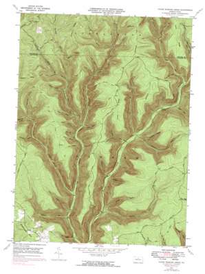
Young Womans Creek Topo Map Pennsylvania
To zoom in, hover over the map of Young Womans Creek
USGS Topo Quad 41077d6 - 1:24,000 scale
| Topo Map Name: | Young Womans Creek |
| USGS Topo Quad ID: | 41077d6 |
| Print Size: | ca. 21 1/4" wide x 27" high |
| Southeast Coordinates: | 41.375° N latitude / 77.625° W longitude |
| Map Center Coordinates: | 41.4375° N latitude / 77.6875° W longitude |
| U.S. State: | PA |
| Filename: | o41077d6.jpg |
| Download Map JPG Image: | Young Womans Creek topo map 1:24,000 scale |
| Map Type: | Topographic |
| Topo Series: | 7.5´ |
| Map Scale: | 1:24,000 |
| Source of Map Images: | United States Geological Survey (USGS) |
| Alternate Map Versions: |
Young Womans Creek PA 1946, updated 1946 Download PDF Buy paper map Young Womans Creek PA 1946, updated 1953 Download PDF Buy paper map Young Womans Creek PA 1946, updated 1972 Download PDF Buy paper map Young Womans Creek PA 1946, updated 1983 Download PDF Buy paper map Young Womans Creek PA 1949 Download PDF Buy paper map Young Womans Creek PA 1994, updated 1999 Download PDF Buy paper map Young Womans Creek PA 2010 Download PDF Buy paper map Young Womans Creek PA 2013 Download PDF Buy paper map Young Womans Creek PA 2016 Download PDF Buy paper map |
1:24,000 Topo Quads surrounding Young Womans Creek
> Back to 41077a1 at 1:100,000 scale
> Back to 41076a1 at 1:250,000 scale
> Back to U.S. Topo Maps home
Young Womans Creek topo map: Gazetteer
Young Womans Creek: Ridges
Laurel Ridge elevation 623m 2043′Lecox Ridge elevation 622m 2040′
Young Womans Creek: Streams
Big Spring Branch elevation 428m 1404′Bull Run elevation 305m 1000′
Greenlick Run elevation 328m 1076′
Laurel Fork elevation 328m 1076′
Laurelly Fork elevation 246m 807′
Lebo Run elevation 348m 1141′
Little Greenlick Run elevation 395m 1295′
McCraney Run elevation 292m 958′
Mudlick Run elevation 240m 787′
Shaney Brook elevation 250m 820′
Shingle Branch elevation 258m 846′
Spring Brook elevation 440m 1443′
Summerson Run elevation 264m 866′
Young Womans Creek: Summits
Summerson Mountain elevation 551m 1807′Young Womans Creek: Trails
Ash Hollow Trail elevation 523m 1715′Beechwood Trail elevation 604m 1981′
Camp Trail elevation 543m 1781′
Cannon Hole Trail elevation 454m 1489′
Daugherty Hollow Trail elevation 624m 2047′
Dug Road Trail elevation 585m 1919′
Fork Hill Trail elevation 457m 1499′
French Trail elevation 618m 2027′
Fye Camp Trail elevation 523m 1715′
Italian Hollow Trail elevation 510m 1673′
Laurelly Hill Trail elevation 399m 1309′
Lecox Ridge Trail elevation 609m 1998′
Lee Hollow Trail elevation 591m 1938′
Little Boyer Mill Trail elevation 377m 1236′
Long Fork Trail elevation 419m 1374′
Mix Hollow Trail elevation 576m 1889′
Morgan Hollow Trail elevation 640m 2099′
Mudlick Trail elevation 425m 1394′
Oxbow Hollow Trail elevation 503m 1650′
Patchell Trail elevation 564m 1850′
Rands Hole Trail elevation 500m 1640′
Rattlesnake Trail elevation 580m 1902′
Shaney Brook Trail elevation 527m 1729′
Shingle Mill Hollow Trail elevation 622m 2040′
Stible Hole Trail elevation 515m 1689′
Stout Hollow Trail elevation 504m 1653′
Wildcat Trail elevation 665m 2181′
Young Womans Creek: Valleys
Ash Hollow elevation 326m 1069′Bee Tree Hollow elevation 322m 1056′
Birch Hollow elevation 332m 1089′
Butler Hollow elevation 341m 1118′
Calamity Hollow elevation 464m 1522′
Daugherty Hollow elevation 333m 1092′
Geyser Hollow elevation 351m 1151′
Ginseng Hollow elevation 382m 1253′
Ingram Hollow elevation 381m 1250′
Long Hollow elevation 405m 1328′
Merriman Hollow elevation 424m 1391′
Oxbow Hollow elevation 338m 1108′
Poplar Hollow elevation 511m 1676′
Post Hollow elevation 230m 754′
Quiggle Hollow elevation 275m 902′
Stout Hollow elevation 254m 833′
Tegerman Hollow elevation 393m 1289′
Young Womans Creek digital topo map on disk
Buy this Young Womans Creek topo map showing relief, roads, GPS coordinates and other geographical features, as a high-resolution digital map file on DVD:
New York, Vermont, Connecticut & Western Massachusetts
Buy digital topo maps: New York, Vermont, Connecticut & Western Massachusetts


