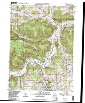
Keeneyville Topo Map Pennsylvania
To zoom in, hover over the map of Keeneyville
USGS Topo Quad 41077g3 - 1:24,000 scale
| Topo Map Name: | Keeneyville |
| USGS Topo Quad ID: | 41077g3 |
| Print Size: | ca. 21 1/4" wide x 27" high |
| Southeast Coordinates: | 41.75° N latitude / 77.25° W longitude |
| Map Center Coordinates: | 41.8125° N latitude / 77.3125° W longitude |
| U.S. State: | PA |
| Filename: | o41077g3.jpg |
| Download Map JPG Image: | Keeneyville topo map 1:24,000 scale |
| Map Type: | Topographic |
| Topo Series: | 7.5´ |
| Map Scale: | 1:24,000 |
| Source of Map Images: | United States Geological Survey (USGS) |
| Alternate Map Versions: |
Kenneyville PA 1954, updated 1956 Download PDF Buy paper map Kenneyville PA 1954, updated 1971 Download PDF Buy paper map Kenneyville PA 1954, updated 1971 Download PDF Buy paper map Keeneyville PA 1994, updated 1998 Download PDF Buy paper map Keeneyville PA 2010 Download PDF Buy paper map Keeneyville PA 2013 Download PDF Buy paper map Keeneyville PA 2016 Download PDF Buy paper map |
1:24,000 Topo Quads surrounding Keeneyville
> Back to 41077e1 at 1:100,000 scale
> Back to 41076a1 at 1:250,000 scale
> Back to U.S. Topo Maps home
Keeneyville topo map: Gazetteer
Keeneyville: Populated Places
Christian Hill elevation 480m 1574′Heise Run elevation 357m 1171′
Keeneyville elevation 373m 1223′
Middlebury Center elevation 348m 1141′
Niles Valley elevation 361m 1184′
Shortsville elevation 403m 1322′
Stokesdale elevation 362m 1187′
Wellsboro Junction elevation 357m 1171′
Keeneyville: Ridges
Oak Ridge elevation 684m 2244′Keeneyville: Springs
Log Cabin Spring elevation 359m 1177′Keeneyville: Streams
Baldwin Run elevation 354m 1161′Canada Run elevation 351m 1151′
Charleston Creek elevation 389m 1276′
Heise Run elevation 351m 1151′
Hemlock Flats Run elevation 454m 1489′
Horse Thief Run elevation 354m 1161′
Kelsey Creek elevation 391m 1282′
Losey Creek elevation 365m 1197′
Morris Branch elevation 389m 1276′
Norris Brook elevation 348m 1141′
Sanders Creek elevation 372m 1220′
Smith Run elevation 351m 1151′
Smith Run elevation 434m 1423′
Wolf Run elevation 351m 1151′
Keeneyville: Summits
Barlow Hill elevation 539m 1768′Cobble Knoll elevation 484m 1587′
Oak Point elevation 675m 2214′
Roundtop elevation 585m 1919′
Keeneyville: Swamps
Morris Marsh elevation 356m 1167′Keeneyville: Trails
Bark Slide Trail elevation 596m 1955′Carpenter Trail elevation 666m 2185′
Cass Trail elevation 583m 1912′
Hemlock Flats Trail elevation 643m 2109′
Lost Trail elevation 638m 2093′
Matson Trail elevation 569m 1866′
Niles Trail elevation 443m 1453′
Oak Ridge Trail elevation 663m 2175′
Roe Trail elevation 684m 2244′
Root Trail elevation 523m 1715′
School House Trail elevation 464m 1522′
Smith Run Trail elevation 524m 1719′
Keeneyville: Valleys
Button Hollow elevation 391m 1282′Catlin Hollow elevation 353m 1158′
Daly Hollow elevation 384m 1259′
Fuller Hollow elevation 365m 1197′
Gee Hollow elevation 363m 1190′
Hibard Hollow elevation 390m 1279′
Keck Hollow elevation 380m 1246′
Keeney Hollow elevation 382m 1253′
Monks Hollow elevation 396m 1299′
Niles Hollow elevation 379m 1243′
Oil Well Hollow elevation 428m 1404′
Roe Hollow elevation 398m 1305′
Root Hollow elevation 406m 1332′
Schoolhouse Hollow elevation 372m 1220′
Spoor Hollow elevation 476m 1561′
Sweet Hollow elevation 364m 1194′
Sweet Hollow elevation 487m 1597′
Wedge Hollow elevation 387m 1269′
Whitehouse Hollow elevation 391m 1282′
Keeneyville digital topo map on disk
Buy this Keeneyville topo map showing relief, roads, GPS coordinates and other geographical features, as a high-resolution digital map file on DVD:
New York, Vermont, Connecticut & Western Massachusetts
Buy digital topo maps: New York, Vermont, Connecticut & Western Massachusetts


