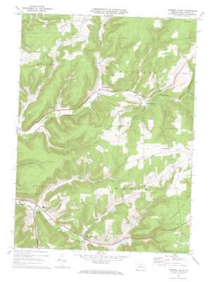
Sweden Valley Topo Map Pennsylvania
To zoom in, hover over the map of Sweden Valley
USGS Topo Quad 41077g8 - 1:24,000 scale
| Topo Map Name: | Sweden Valley |
| USGS Topo Quad ID: | 41077g8 |
| Print Size: | ca. 21 1/4" wide x 27" high |
| Southeast Coordinates: | 41.75° N latitude / 77.875° W longitude |
| Map Center Coordinates: | 41.8125° N latitude / 77.9375° W longitude |
| U.S. State: | PA |
| Filename: | o41077g8.jpg |
| Download Map JPG Image: | Sweden Valley topo map 1:24,000 scale |
| Map Type: | Topographic |
| Topo Series: | 7.5´ |
| Map Scale: | 1:24,000 |
| Source of Map Images: | United States Geological Survey (USGS) |
| Alternate Map Versions: |
Sweden Valley PA 1969, updated 1972 Download PDF Buy paper map Sweden Valley PA 2010 Download PDF Buy paper map Sweden Valley PA 2013 Download PDF Buy paper map Sweden Valley PA 2016 Download PDF Buy paper map |
1:24,000 Topo Quads surrounding Sweden Valley
> Back to 41077e1 at 1:100,000 scale
> Back to 41076a1 at 1:250,000 scale
> Back to U.S. Topo Maps home
Sweden Valley topo map: Gazetteer
Sweden Valley: Mines
Ice Mine elevation 585m 1919′Sweden Valley: Populated Places
Colesburg elevation 568m 1863′Denton Hill elevation 742m 2434′
Frinks elevation 542m 1778′
Ice Mine elevation 555m 1820′
Lymansville elevation 524m 1719′
Sweden Valley elevation 547m 1794′
Sweden Valley: Streams
Dry Run elevation 578m 1896′Dwight Creek elevation 577m 1893′
Lyman Creek elevation 539m 1768′
Peet Brook elevation 561m 1840′
Trout Run elevation 546m 1791′
Woodcock Creek elevation 626m 2053′
Sweden Valley: Summits
Lyon Hill elevation 785m 2575′Sweden Hill elevation 757m 2483′
Sweden Valley: Valleys
Gross Hollow elevation 615m 2017′Haskell Hollow elevation 571m 1873′
Kohler Hollow elevation 592m 1942′
Lent Hollow elevation 549m 1801′
North Hollow elevation 526m 1725′
Pigeon Hollow elevation 600m 1968′
Prosser Hollow elevation 548m 1797′
South Hollow elevation 524m 1719′
Toombs Hollow elevation 598m 1961′
Wambold Hollow elevation 611m 2004′
Sweden Valley digital topo map on disk
Buy this Sweden Valley topo map showing relief, roads, GPS coordinates and other geographical features, as a high-resolution digital map file on DVD:
New York, Vermont, Connecticut & Western Massachusetts
Buy digital topo maps: New York, Vermont, Connecticut & Western Massachusetts


