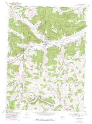
Knoxville Topo Map Pennsylvania
To zoom in, hover over the map of Knoxville
USGS Topo Quad 41077h4 - 1:24,000 scale
| Topo Map Name: | Knoxville |
| USGS Topo Quad ID: | 41077h4 |
| Print Size: | ca. 21 1/4" wide x 27" high |
| Southeast Coordinates: | 41.875° N latitude / 77.375° W longitude |
| Map Center Coordinates: | 41.9375° N latitude / 77.4375° W longitude |
| U.S. States: | PA, NY |
| Filename: | o41077h4.jpg |
| Download Map JPG Image: | Knoxville topo map 1:24,000 scale |
| Map Type: | Topographic |
| Topo Series: | 7.5´ |
| Map Scale: | 1:24,000 |
| Source of Map Images: | United States Geological Survey (USGS) |
| Alternate Map Versions: |
Knoxville PA 1954, updated 1956 Download PDF Buy paper map Knoxville PA 1954, updated 1971 Download PDF Buy paper map Knoxville PA 1954, updated 1980 Download PDF Buy paper map Knoxville PA 2010 Download PDF Buy paper map Knoxville PA 2013 Download PDF Buy paper map Knoxville PA 2016 Download PDF Buy paper map |
1:24,000 Topo Quads surrounding Knoxville
> Back to 41077e1 at 1:100,000 scale
> Back to 41076a1 at 1:250,000 scale
> Back to U.S. Topo Maps home
Knoxville topo map: Gazetteer
Knoxville: Populated Places
Austinburg elevation 418m 1371′Cowanesque elevation 400m 1312′
Knoxville elevation 379m 1243′
Little Marsh elevation 425m 1394′
Phillips elevation 390m 1279′
Knoxville: Reservoirs
Knoxville Reservoir elevation 463m 1519′Knoxville: Streams
Blair Creek elevation 424m 1391′Boatman Brook elevation 380m 1246′
Bulkley Brook elevation 421m 1381′
Bulkley Brook elevation 421m 1381′
Carpenter Run elevation 366m 1200′
Christie Run elevation 399m 1309′
Crotch Run elevation 390m 1279′
Jemison Creek elevation 390m 1279′
South Brook Troups Creek elevation 412m 1351′
Troups Creek elevation 378m 1240′
Troups Creek elevation 376m 1233′
Yarnell Brook elevation 366m 1200′
Knoxville: Summits
Fork Hill elevation 640m 2099′Knoxville: Valleys
Abbott Hollow elevation 404m 1325′Biscuit Hollow elevation 407m 1335′
Biscuit Hollow elevation 407m 1335′
Cook Hollow elevation 414m 1358′
Hornby Hollow elevation 447m 1466′
Moffit Hollow elevation 390m 1279′
Red House Hollow elevation 440m 1443′
Rose Valley elevation 395m 1295′
Skinner Hollow elevation 402m 1318′
Wheaton Hollow elevation 385m 1263′
Wood Hollow elevation 410m 1345′
Knoxville digital topo map on disk
Buy this Knoxville topo map showing relief, roads, GPS coordinates and other geographical features, as a high-resolution digital map file on DVD:
New York, Vermont, Connecticut & Western Massachusetts
Buy digital topo maps: New York, Vermont, Connecticut & Western Massachusetts


