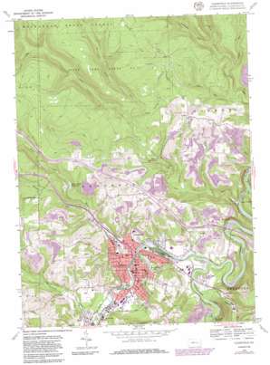
Clearfield Topo Map Pennsylvania
To zoom in, hover over the map of Clearfield
USGS Topo Quad 41078a4 - 1:24,000 scale
| Topo Map Name: | Clearfield |
| USGS Topo Quad ID: | 41078a4 |
| Print Size: | ca. 21 1/4" wide x 27" high |
| Southeast Coordinates: | 41° N latitude / 78.375° W longitude |
| Map Center Coordinates: | 41.0625° N latitude / 78.4375° W longitude |
| U.S. State: | PA |
| Filename: | o41078a4.jpg |
| Download Map JPG Image: | Clearfield topo map 1:24,000 scale |
| Map Type: | Topographic |
| Topo Series: | 7.5´ |
| Map Scale: | 1:24,000 |
| Source of Map Images: | United States Geological Survey (USGS) |
| Alternate Map Versions: |
Clearfield PA 1959, updated 1961 Download PDF Buy paper map Clearfield PA 1959, updated 1970 Download PDF Buy paper map Clearfield PA 1959, updated 1972 Download PDF Buy paper map Clearfield PA 1959, updated 1981 Download PDF Buy paper map Clearfield PA 1959, updated 1986 Download PDF Buy paper map Clearfield PA 2010 Download PDF Buy paper map Clearfield PA 2013 Download PDF Buy paper map Clearfield PA 2016 Download PDF Buy paper map |
1:24,000 Topo Quads surrounding Clearfield
> Back to 41078a1 at 1:100,000 scale
> Back to 41078a1 at 1:250,000 scale
> Back to U.S. Topo Maps home
Clearfield topo map: Gazetteer
Clearfield: Airports
Clearfield-Lawrence Airport elevation 453m 1486′Clearfield: Dams
Moose Creek Reservoir Dam elevation 443m 1453′Clearfield: Parks
State Game Lands Number 90 elevation 561m 1840′Clearfield: Populated Places
Baney Settlement elevation 372m 1220′Barrett elevation 384m 1259′
Clearfield elevation 332m 1089′
Clearfield Junction elevation 357m 1171′
Golden Rod Farms elevation 354m 1161′
Goshen elevation 443m 1453′
Hyde elevation 331m 1085′
Kerr Addition elevation 341m 1118′
Leonard elevation 357m 1171′
Mount Joy elevation 443m 1453′
Plymptonville elevation 420m 1377′
Plymtonville elevation 340m 1115′
Riverview elevation 336m 1102′
Clearfield: Reservoirs
Moose Creek Reservoir elevation 421m 1381′Clearfield: Streams
Clearfield Creek elevation 326m 1069′Coldstream Run elevation 414m 1358′
Crooked Run elevation 389m 1276′
Devils Run elevation 320m 1049′
Flegals Run elevation 347m 1138′
Fork Run elevation 383m 1256′
Jerry Run elevation 354m 1161′
Lick Run elevation 320m 1049′
Montgomery Creek elevation 329m 1079′
Moose Creek elevation 330m 1082′
Pine Run elevation 372m 1220′
Roaring Run elevation 335m 1099′
Stone Run elevation 401m 1315′
Wolf Run elevation 336m 1102′
Woods Run elevation 376m 1233′
Clearfield: Valleys
Cozy Hollow elevation 417m 1368′Clearfield digital topo map on disk
Buy this Clearfield topo map showing relief, roads, GPS coordinates and other geographical features, as a high-resolution digital map file on DVD:


