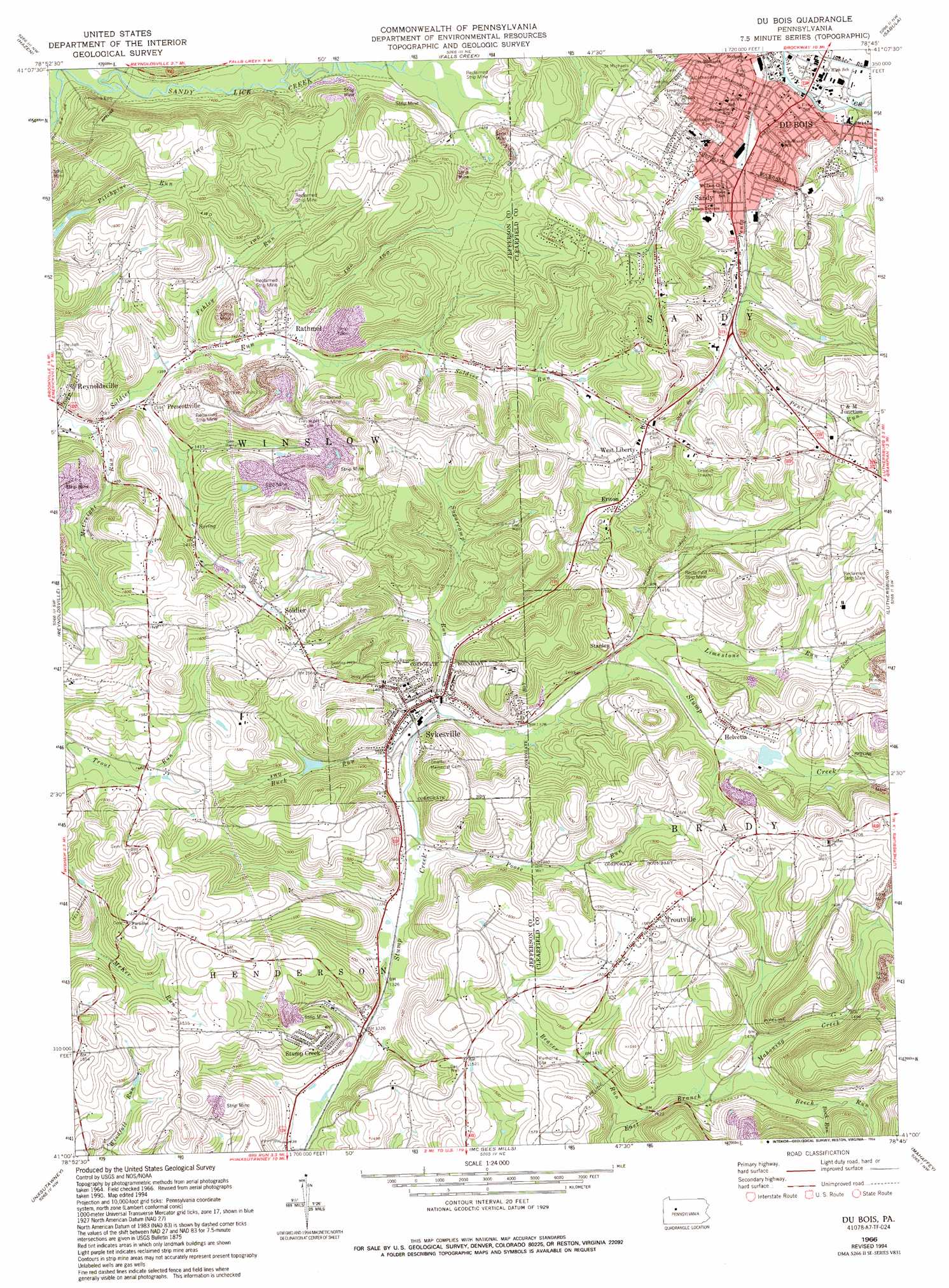
Du Bois Topo Map Pennsylvania
To zoom in, hover over the map of Du Bois
USGS Topo Quad 41078a7 - 1:24,000 scale
| Topo Map Name: | Du Bois |
| USGS Topo Quad ID: | 41078a7 |
| Print Size: | ca. 21 1/4" wide x 27" high |
| Southeast Coordinates: | 41° N latitude / 78.75° W longitude |
| Map Center Coordinates: | 41.0625° N latitude / 78.8125° W longitude |
| U.S. State: | PA |
| Filename: | o41078a7.jpg |
| Download Map JPG Image: | Du Bois topo map 1:24,000 scale |
| Map Type: | Topographic |
| Topo Series: | 7.5´ |
| Map Scale: | 1:24,000 |
| Source of Map Images: | United States Geological Survey (USGS) |
| Alternate Map Versions: |
Du Bois PA 1966, updated 1968 Download PDF Buy paper map Du Bois PA 1966, updated 1973 Download PDF Buy paper map Du Bois PA 1966, updated 1982 Download PDF Buy paper map Du Bois PA 1966, updated 1986 Download PDF Buy paper map Du Bois PA 1966, updated 1994 Download PDF Buy paper map Du Bois PA 1966, updated 1994 Download PDF Buy paper map Du Bois PA 2010 Download PDF Buy paper map Du Bois PA 2013 Download PDF Buy paper map Du Bois PA 2016 Download PDF Buy paper map |
1:24,000 Topo Quads surrounding Du Bois
Sigel |
Munderf |
Carman |
Brandy Camp |
Kersey |
Brookville |
Hazen |
Falls Creek |
Sabula |
Penfield |
Coolspring |
Reynoldsville |
Du Bois |
Luthersburg |
Elliott Park |
Valier |
Punxsutawney |
Mcgees Mills |
Mahaffey |
Curwensville |
Marion Center |
Rochester Mills |
Burnside |
Westover |
Irvona |
> Back to 41078a1 at 1:100,000 scale
> Back to 41078a1 at 1:250,000 scale
> Back to U.S. Topo Maps home
Du Bois topo map: Gazetteer
Du Bois: Dams
Helvetia Dam elevation 429m 1407′Reynoldsville Storage Dam elevation 458m 1502′
Du Bois: Populated Places
C and M Junction elevation 460m 1509′Cramer elevation 410m 1345′
Du Bois elevation 430m 1410′
Eriton elevation 467m 1532′
Helvetia elevation 436m 1430′
Prescottville elevation 425m 1394′
Rathmel elevation 432m 1417′
Sandy elevation 436m 1430′
Soldier elevation 450m 1476′
Stanley elevation 426m 1397′
Stump Creek elevation 449m 1473′
Sykesville elevation 415m 1361′
Troutville elevation 483m 1584′
West Liberty elevation 492m 1614′
Du Bois: Reservoirs
Reynoldsville Reservoir elevation 458m 1502′Du Bois: Streams
Beaver Run elevation 426m 1397′Beech Run elevation 439m 1440′
Buck Run elevation 407m 1335′
Buck Run elevation 453m 1486′
Fehley Run elevation 426m 1397′
Juniata Run elevation 426m 1397′
Limestone Run elevation 419m 1374′
McCreight Run elevation 420m 1377′
Panther Run elevation 417m 1368′
Pentz Run elevation 423m 1387′
Poose Run elevation 405m 1328′
Reisinger Run elevation 426m 1397′
Sugarcamp Run elevation 411m 1348′
Du Bois digital topo map on disk
Buy this Du Bois topo map showing relief, roads, GPS coordinates and other geographical features, as a high-resolution digital map file on DVD:
 map DVD")