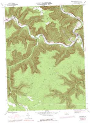
Driftwood Topo Map Pennsylvania
To zoom in, hover over the map of Driftwood
USGS Topo Quad 41078c2 - 1:24,000 scale
| Topo Map Name: | Driftwood |
| USGS Topo Quad ID: | 41078c2 |
| Print Size: | ca. 21 1/4" wide x 27" high |
| Southeast Coordinates: | 41.25° N latitude / 78.125° W longitude |
| Map Center Coordinates: | 41.3125° N latitude / 78.1875° W longitude |
| U.S. State: | PA |
| Filename: | o41078c2.jpg |
| Download Map JPG Image: | Driftwood topo map 1:24,000 scale |
| Map Type: | Topographic |
| Topo Series: | 7.5´ |
| Map Scale: | 1:24,000 |
| Source of Map Images: | United States Geological Survey (USGS) |
| Alternate Map Versions: |
Driftwood PA 1945, updated 1955 Download PDF Buy paper map Driftwood PA 1945, updated 1972 Download PDF Buy paper map Driftwood PA 1945, updated 1991 Download PDF Buy paper map Driftwood PA 1947 Download PDF Buy paper map Driftwood PA 1947 Download PDF Buy paper map Driftwood PA 2010 Download PDF Buy paper map Driftwood PA 2013 Download PDF Buy paper map Driftwood PA 2016 Download PDF Buy paper map |
1:24,000 Topo Quads surrounding Driftwood
> Back to 41078a1 at 1:100,000 scale
> Back to 41078a1 at 1:250,000 scale
> Back to U.S. Topo Maps home
Driftwood topo map: Gazetteer
Driftwood: Areas
Johnson Run State Forest Natural Area elevation 305m 1000′Driftwood: Populated Places
Castle Garden elevation 249m 816′Driftwood elevation 259m 849′
Hicks Run elevation 278m 912′
Huntley elevation 269m 882′
Mix Run elevation 263m 862′
Driftwood: Streams
Barrs Run elevation 276m 905′Beaverdam Run elevation 262m 859′
Bennett Branch Sinnemahoning Creek elevation 238m 780′
Boyer Run elevation 244m 800′
Driftwood Branch Sinnemahoning Creek elevation 238m 780′
Dry Run elevation 262m 859′
Foley Branch elevation 332m 1089′
Gravel Lick elevation 308m 1010′
Johnson Run elevation 251m 823′
Left Fork Miller Run elevation 312m 1023′
Little Dent Run elevation 251m 823′
Lower Pine Run elevation 310m 1017′
Miller Run elevation 262m 859′
Mix Run elevation 262m 859′
Nanny Run elevation 249m 816′
Nelson Run elevation 254m 833′
Paige Run elevation 412m 1351′
Red Run elevation 326m 1069′
Stone Quarry Run elevation 256m 839′
Tanglefoot Run elevation 267m 875′
Driftwood: Summits
Mason Hill elevation 620m 2034′Driftwood: Valleys
Archie Barr Hollow elevation 312m 1023′Bearpen Hollow elevation 276m 905′
Foley Draft elevation 451m 1479′
Gore Draft elevation 390m 1279′
Grindstone Hollow elevation 264m 866′
Hicks Hollow elevation 274m 898′
Horsehead Hollow elevation 291m 954′
Laurel Draft elevation 333m 1092′
Little Fork Draft elevation 304m 997′
Porcupine Draft elevation 358m 1174′
Sanders Draft elevation 409m 1341′
Stone Quarry Hollow elevation 572m 1876′
Upper Pine Draft elevation 394m 1292′
Upper Pine Hollow elevation 339m 1112′
Water Plug Hollow elevation 287m 941′
White Oak Draft elevation 328m 1076′
Driftwood digital topo map on disk
Buy this Driftwood topo map showing relief, roads, GPS coordinates and other geographical features, as a high-resolution digital map file on DVD:


