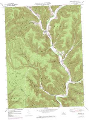
Wharton Topo Map Pennsylvania
To zoom in, hover over the map of Wharton
USGS Topo Quad 41078e1 - 1:24,000 scale
| Topo Map Name: | Wharton |
| USGS Topo Quad ID: | 41078e1 |
| Print Size: | ca. 21 1/4" wide x 27" high |
| Southeast Coordinates: | 41.5° N latitude / 78° W longitude |
| Map Center Coordinates: | 41.5625° N latitude / 78.0625° W longitude |
| U.S. State: | PA |
| Filename: | o41078e1.jpg |
| Download Map JPG Image: | Wharton topo map 1:24,000 scale |
| Map Type: | Topographic |
| Topo Series: | 7.5´ |
| Map Scale: | 1:24,000 |
| Source of Map Images: | United States Geological Survey (USGS) |
| Alternate Map Versions: |
Wharton PA 1948, updated 1958 Download PDF Buy paper map Wharton PA 1948, updated 1972 Download PDF Buy paper map Wharton PA 1948, updated 1984 Download PDF Buy paper map Wharton PA 1950 Download PDF Buy paper map Wharton PA 1950 Download PDF Buy paper map Wharton PA 1994, updated 1999 Download PDF Buy paper map Wharton PA 2010 Download PDF Buy paper map Wharton PA 2013 Download PDF Buy paper map Wharton PA 2016 Download PDF Buy paper map |
1:24,000 Topo Quads surrounding Wharton
> Back to 41078e1 at 1:100,000 scale
> Back to 41078a1 at 1:250,000 scale
> Back to U.S. Topo Maps home
Wharton topo map: Gazetteer
Wharton: Dams
Splash Dam elevation 384m 1259′Wharton: Populated Places
Costello elevation 366m 1200′Wharton elevation 336m 1102′
Wharton: Streams
Bailey Run elevation 326m 1069′Big Nelson Run elevation 344m 1128′
East Darian Run elevation 355m 1164′
East Fork Sinnemahoning Creek elevation 329m 1079′
Elk Lick Run elevation 328m 1076′
Freeman Run elevation 364m 1194′
Left Branch Big Nelson Run elevation 382m 1253′
Little Bailey Run elevation 348m 1141′
Little Nelson Run elevation 337m 1105′
Little Portage Creek elevation 418m 1371′
Pine Island Run elevation 334m 1095′
Right Branch Bailey Run elevation 425m 1394′
Right Branch Big Nelson Run elevation 382m 1253′
Schoolhouse Run elevation 327m 1072′
Shanty Branch elevation 487m 1597′
South Branch Little Portage Creek elevation 401m 1315′
South Woods Branch elevation 378m 1240′
State Road Branch elevation 487m 1597′
West Darian Run elevation 353m 1158′
Wharton: Valleys
Avery Hollow elevation 350m 1148′Bentley Hollow elevation 347m 1138′
Big Carlson Hollow elevation 462m 1515′
Brainard Hollow elevation 374m 1227′
Butternut Hollow elevation 382m 1253′
Card Hollow elevation 418m 1371′
Colbert Hollow elevation 441m 1446′
Cooney Hollow elevation 380m 1246′
Cooney Hollow elevation 455m 1492′
Deloy Hollow elevation 418m 1371′
Dry Hollow elevation 332m 1089′
Fish Basket Hollow elevation 355m 1164′
Gas Well Hollow elevation 406m 1332′
Kirkendahl Hollow elevation 401m 1315′
Layton Hollow elevation 371m 1217′
Little Carlson Hollow elevation 431m 1414′
Moore Draft elevation 413m 1354′
Post Hollow elevation 418m 1371′
Railroad Hollow elevation 474m 1555′
Ripple Hollow elevation 389m 1276′
Road Hollow elevation 379m 1243′
Schoolhouse Hollow elevation 396m 1299′
Sprague Hollow elevation 435m 1427′
Young Hollow elevation 376m 1233′
Wharton digital topo map on disk
Buy this Wharton topo map showing relief, roads, GPS coordinates and other geographical features, as a high-resolution digital map file on DVD:


