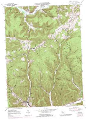
Austin Topo Map Pennsylvania
To zoom in, hover over the map of Austin
USGS Topo Quad 41078f1 - 1:24,000 scale
| Topo Map Name: | Austin |
| USGS Topo Quad ID: | 41078f1 |
| Print Size: | ca. 21 1/4" wide x 27" high |
| Southeast Coordinates: | 41.625° N latitude / 78° W longitude |
| Map Center Coordinates: | 41.6875° N latitude / 78.0625° W longitude |
| U.S. State: | PA |
| Filename: | o41078f1.jpg |
| Download Map JPG Image: | Austin topo map 1:24,000 scale |
| Map Type: | Topographic |
| Topo Series: | 7.5´ |
| Map Scale: | 1:24,000 |
| Source of Map Images: | United States Geological Survey (USGS) |
| Alternate Map Versions: |
Austin PA 1948, updated 1965 Download PDF Buy paper map Austin PA 1948, updated 1972 Download PDF Buy paper map Austin PA 1948, updated 1989 Download PDF Buy paper map Austin PA 1948, updated 1989 Download PDF Buy paper map Austin PA 1950 Download PDF Buy paper map Austin PA 1950, updated 1950 Download PDF Buy paper map Austin PA 2010 Download PDF Buy paper map Austin PA 2013 Download PDF Buy paper map Austin PA 2016 Download PDF Buy paper map |
1:24,000 Topo Quads surrounding Austin
> Back to 41078e1 at 1:100,000 scale
> Back to 41078a1 at 1:250,000 scale
> Back to U.S. Topo Maps home
Austin topo map: Gazetteer
Austin: Airports
Ranch-Aero Airport elevation 479m 1571′Austin: Flats
Elm Flat elevation 519m 1702′Austin: Populated Places
Austin elevation 411m 1348′Inez elevation 567m 1860′
Mina elevation 486m 1594′
Odin elevation 510m 1673′
Austin: Post Offices
Homer Post Office (historical) elevation 561m 1840′Austin: Streams
Baker Run elevation 465m 1525′Big Moores Run elevation 404m 1325′
Dry Run elevation 414m 1358′
East Branch Freeman Run elevation 512m 1679′
Gravel Lick Run elevation 394m 1292′
Heth Run elevation 524m 1719′
Jacob Run elevation 467m 1532′
Jones Run elevation 463m 1519′
Lehman Run elevation 482m 1581′
Little Moores Run elevation 420m 1377′
Pine Run elevation 506m 1660′
Town Run elevation 482m 1581′
West Branch Freeman Run elevation 405m 1328′
Austin: Summits
Mina Hill elevation 709m 2326′Austin: Trails
Aspen Trail elevation 587m 1925′Blue Coat Trail elevation 574m 1883′
Bridge Trail elevation 628m 2060′
Fork Hill Trail elevation 622m 2040′
Hemlock Trail elevation 627m 2057′
Moores Run Fire Trail elevation 632m 2073′
Odin Hoxie Trail elevation 637m 2089′
Ridge Trail elevation 622m 2040′
White Birch Trail elevation 621m 2037′
Austin: Valleys
Baker Hollow elevation 470m 1541′Bark Shanty Hollow elevation 496m 1627′
Barren Hollow elevation 456m 1496′
Bear Hollow elevation 534m 1751′
Big Tree Hollow elevation 512m 1679′
Big Younglove Hollow elevation 461m 1512′
Campbell Hollow elevation 503m 1650′
Cherry Hollow elevation 518m 1699′
Cochrane Hollow elevation 426m 1397′
Cody Hollow elevation 421m 1381′
Coon Chastain Hollow elevation 514m 1686′
Donovan Hollow elevation 426m 1397′
Dry Hollow elevation 485m 1591′
Elevenmile Hollow elevation 397m 1302′
Garretson Hollow elevation 413m 1354′
Gas Well Hollow elevation 482m 1581′
Gleason Hollow elevation 494m 1620′
Harrier Hollow elevation 461m 1512′
Hill Hollow elevation 547m 1794′
Horn Hollow elevation 433m 1420′
Left Branch Bark Shanty Hollow elevation 534m 1751′
McNamara Hollow elevation 542m 1778′
Nestor Hollow elevation 401m 1315′
Odin Hollow elevation 522m 1712′
Postalweight Hollow elevation 548m 1797′
Powder Horn Hollow elevation 481m 1578′
Pump Station Hollow elevation 498m 1633′
Right Branch Bark Shanty Hollow elevation 534m 1751′
Rock Hollow elevation 503m 1650′
Sharps Hollow elevation 537m 1761′
South Hollow elevation 526m 1725′
Stuckey Hollow elevation 467m 1532′
Windfall Hollow elevation 523m 1715′
Woodbury Hollow elevation 536m 1758′
Wooley Lot Hollow elevation 563m 1847′
Austin digital topo map on disk
Buy this Austin topo map showing relief, roads, GPS coordinates and other geographical features, as a high-resolution digital map file on DVD:


