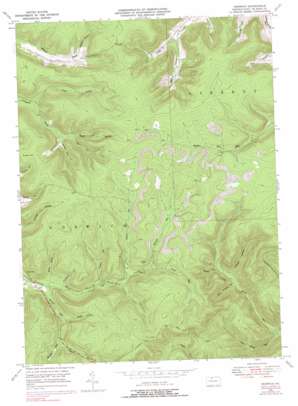
Norwich Topo Map Pennsylvania
To zoom in, hover over the map of Norwich
USGS Topo Quad 41078f3 - 1:24,000 scale
| Topo Map Name: | Norwich |
| USGS Topo Quad ID: | 41078f3 |
| Print Size: | ca. 21 1/4" wide x 27" high |
| Southeast Coordinates: | 41.625° N latitude / 78.25° W longitude |
| Map Center Coordinates: | 41.6875° N latitude / 78.3125° W longitude |
| U.S. State: | PA |
| Filename: | o41078f3.jpg |
| Download Map JPG Image: | Norwich topo map 1:24,000 scale |
| Map Type: | Topographic |
| Topo Series: | 7.5´ |
| Map Scale: | 1:24,000 |
| Source of Map Images: | United States Geological Survey (USGS) |
| Alternate Map Versions: |
Norwich PA 1948, updated 1965 Download PDF Buy paper map Norwich PA 1948, updated 1972 Download PDF Buy paper map Norwich PA 1948, updated 1978 Download PDF Buy paper map Norwich PA 1948, updated 1991 Download PDF Buy paper map Norwich PA 1950 Download PDF Buy paper map Norwich PA 2010 Download PDF Buy paper map Norwich PA 2013 Download PDF Buy paper map Norwich PA 2016 Download PDF Buy paper map |
1:24,000 Topo Quads surrounding Norwich
> Back to 41078e1 at 1:100,000 scale
> Back to 41078a1 at 1:250,000 scale
> Back to U.S. Topo Maps home
Norwich topo map: Gazetteer
Norwich: Forests
Susquehanna State Forest elevation 667m 2188′Norwich: Parks
State Game Lands Number 30 elevation 700m 2296′Norwich: Populated Places
Norwich elevation 496m 1627′Norwich: Streams
East Branch Potato Creek elevation 493m 1617′Hamlin Run elevation 533m 1748′
Hand Brook elevation 493m 1617′
Havens Run elevation 493m 1617′
Little Parker Run elevation 426m 1397′
Lyman Run elevation 560m 1837′
North Branch Colegrove Brook elevation 493m 1617′
Panther Run elevation 516m 1692′
Railroad Run elevation 560m 1837′
Taylor Field Branch elevation 528m 1732′
Norwich: Summits
Evans Hill elevation 688m 2257′Jay Cox Hill elevation 695m 2280′
Norwich: Valleys
Doubler Hollow elevation 481m 1578′Keesler Hollow elevation 540m 1771′
Larson Hollow elevation 527m 1729′
McAllister Hollow elevation 502m 1646′
O'Brien Hollow elevation 474m 1555′
Pigeon Hollow elevation 534m 1751′
Porcupine Hollow elevation 498m 1633′
Saltlog Hollow elevation 538m 1765′
Squab Hollow elevation 522m 1712′
Stone Chimney Hollow elevation 467m 1532′
Strang Hollow elevation 517m 1696′
Norwich digital topo map on disk
Buy this Norwich topo map showing relief, roads, GPS coordinates and other geographical features, as a high-resolution digital map file on DVD:


