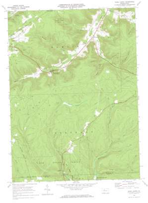
Hazel Hurst Topo Map Pennsylvania
To zoom in, hover over the map of Hazel Hurst
USGS Topo Quad 41078f5 - 1:24,000 scale
| Topo Map Name: | Hazel Hurst |
| USGS Topo Quad ID: | 41078f5 |
| Print Size: | ca. 21 1/4" wide x 27" high |
| Southeast Coordinates: | 41.625° N latitude / 78.5° W longitude |
| Map Center Coordinates: | 41.6875° N latitude / 78.5625° W longitude |
| U.S. State: | PA |
| Filename: | o41078f5.jpg |
| Download Map JPG Image: | Hazel Hurst topo map 1:24,000 scale |
| Map Type: | Topographic |
| Topo Series: | 7.5´ |
| Map Scale: | 1:24,000 |
| Source of Map Images: | United States Geological Survey (USGS) |
| Alternate Map Versions: |
Hazel Hurst PA 1969, updated 1972 Download PDF Buy paper map Hazel Hurst PA 2010 Download PDF Buy paper map Hazel Hurst PA 2013 Download PDF Buy paper map Hazel Hurst PA 2016 Download PDF Buy paper map |
1:24,000 Topo Quads surrounding Hazel Hurst
> Back to 41078e1 at 1:100,000 scale
> Back to 41078a1 at 1:250,000 scale
> Back to U.S. Topo Maps home
Hazel Hurst topo map: Gazetteer
Hazel Hurst: Parks
State Game Lands Number 62 elevation 657m 2155′Hazel Hurst: Populated Places
Hazel Hurst elevation 526m 1725′Kasson elevation 486m 1594′
Kushequa elevation 534m 1751′
Marvindale elevation 494m 1620′
Williamsville elevation 528m 1732′
Hazel Hurst: Streams
Buck Run elevation 542m 1778′Cold Spring Run elevation 586m 1922′
County Line Run elevation 515m 1689′
Doe Run elevation 567m 1860′
Gum Boot Run elevation 553m 1814′
Jet Brook elevation 495m 1624′
Kane Creek elevation 525m 1722′
Martin Run elevation 597m 1958′
Sevenmile Run elevation 515m 1689′
Smith Run elevation 524m 1719′
Stanton Brook elevation 484m 1587′
Warner Brook elevation 488m 1601′
Wildcat Run elevation 503m 1650′
Hazel Hurst: Summits
Bishops Summit elevation 651m 2135′Hazel Hurst: Swamps
Cathrine Swamp elevation 626m 2053′Hazel Hurst: Valleys
Bloomster Hollow elevation 486m 1594′Rock Hollow elevation 523m 1715′
Shelander Hollow elevation 536m 1758′
Shingle Mill Hollow elevation 554m 1817′
Slick Hollow elevation 510m 1673′
Stone Dock Hollow elevation 548m 1797′
Wildcat Hollow elevation 506m 1660′
Hazel Hurst digital topo map on disk
Buy this Hazel Hurst topo map showing relief, roads, GPS coordinates and other geographical features, as a high-resolution digital map file on DVD:


