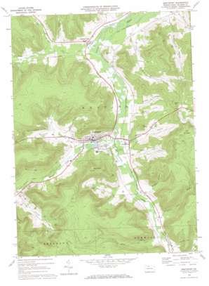
Smethport Topo Map Pennsylvania
To zoom in, hover over the map of Smethport
USGS Topo Quad 41078g4 - 1:24,000 scale
| Topo Map Name: | Smethport |
| USGS Topo Quad ID: | 41078g4 |
| Print Size: | ca. 21 1/4" wide x 27" high |
| Southeast Coordinates: | 41.75° N latitude / 78.375° W longitude |
| Map Center Coordinates: | 41.8125° N latitude / 78.4375° W longitude |
| U.S. State: | PA |
| Filename: | o41078g4.jpg |
| Download Map JPG Image: | Smethport topo map 1:24,000 scale |
| Map Type: | Topographic |
| Topo Series: | 7.5´ |
| Map Scale: | 1:24,000 |
| Source of Map Images: | United States Geological Survey (USGS) |
| Alternate Map Versions: |
Smethport PA 1969, updated 1972 Download PDF Buy paper map Smethport PA 2010 Download PDF Buy paper map Smethport PA 2013 Download PDF Buy paper map Smethport PA 2016 Download PDF Buy paper map |
1:24,000 Topo Quads surrounding Smethport
> Back to 41078e1 at 1:100,000 scale
> Back to 41078a1 at 1:250,000 scale
> Back to U.S. Topo Maps home
Smethport topo map: Gazetteer
Smethport: Dams
Hamlin Lake Park Dam elevation 445m 1459′Smethport: Oilfields
Marvin Creek Oil Field elevation 503m 1650′Sartwell Oil Field elevation 664m 2178′
Smethport: Parks
State Game Lands Number 301 elevation 439m 1440′Smethport: Populated Places
East Smethport elevation 461m 1512′Farmers Valley elevation 457m 1499′
Smethport elevation 475m 1558′
Smethport: Reservoirs
Hamlin Lake elevation 445m 1459′Smethport: Streams
Blacksmith Run elevation 451m 1479′Boyer Brook elevation 456m 1496′
Cole Creek elevation 440m 1443′
Daly Brook elevation 453m 1486′
Ice Pond Brook elevation 463m 1519′
Marvin Creek elevation 440m 1443′
North Branch Cole Creek elevation 448m 1469′
Pierce Brook elevation 439m 1440′
South Branch Cole Creek elevation 448m 1469′
Tyler Brook elevation 448m 1469′
Smethport: Summits
Bush Hill elevation 668m 2191′Devils Den elevation 627m 2057′
Prospect Hill elevation 745m 2444′
The Nipple elevation 613m 2011′
Smethport: Valleys
Brooder Hollow elevation 463m 1519′Burbank Hollow elevation 461m 1512′
Champlin Hollow elevation 452m 1482′
Cloverlot Hollow elevation 470m 1541′
Diegel Hollow elevation 439m 1440′
Gifford Hollow elevation 459m 1505′
Hacket Hollow elevation 453m 1486′
Irish Hollow elevation 461m 1512′
Irons Hollow elevation 472m 1548′
Kent Hollow elevation 450m 1476′
Reilly Hollow elevation 464m 1522′
Stickles Hollow elevation 453m 1486′
Smethport digital topo map on disk
Buy this Smethport topo map showing relief, roads, GPS coordinates and other geographical features, as a high-resolution digital map file on DVD:


