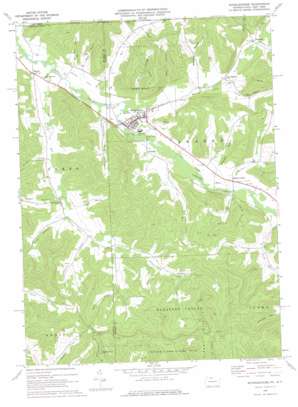
Shinglehouse Topo Map Pennsylvania
To zoom in, hover over the map of Shinglehouse
USGS Topo Quad 41078h2 - 1:24,000 scale
| Topo Map Name: | Shinglehouse |
| USGS Topo Quad ID: | 41078h2 |
| Print Size: | ca. 21 1/4" wide x 27" high |
| Southeast Coordinates: | 41.875° N latitude / 78.125° W longitude |
| Map Center Coordinates: | 41.9375° N latitude / 78.1875° W longitude |
| U.S. States: | PA, NY |
| Filename: | o41078h2.jpg |
| Download Map JPG Image: | Shinglehouse topo map 1:24,000 scale |
| Map Type: | Topographic |
| Topo Series: | 7.5´ |
| Map Scale: | 1:24,000 |
| Source of Map Images: | United States Geological Survey (USGS) |
| Alternate Map Versions: |
Shinglehouse PA 1969, updated 1972 Download PDF Buy paper map Shinglehouse PA 1969, updated 1976 Download PDF Buy paper map Shinglehouse PA 2010 Download PDF Buy paper map Shinglehouse PA 2013 Download PDF Buy paper map Shinglehouse PA 2016 Download PDF Buy paper map |
1:24,000 Topo Quads surrounding Shinglehouse
> Back to 41078e1 at 1:100,000 scale
> Back to 41078a1 at 1:250,000 scale
> Back to U.S. Topo Maps home
Shinglehouse topo map: Gazetteer
Shinglehouse: Populated Places
East Sharon elevation 453m 1486′Honeoye elevation 467m 1532′
Myrtle elevation 445m 1459′
Sharon Center elevation 465m 1525′
Shaytown elevation 542m 1778′
Shinglehouse elevation 454m 1489′
Sunnyside elevation 464m 1522′
Shinglehouse: Streams
Bell Run elevation 442m 1450′Butter Creek elevation 459m 1505′
Chapman Brook elevation 491m 1610′
Cow Run elevation 453m 1486′
Honeoye Creek elevation 450m 1476′
Honeoye Creek elevation 450m 1476′
Horse Run elevation 445m 1459′
Horse Run elevation 445m 1459′
Janders Run elevation 450m 1476′
Plank Creek elevation 451m 1479′
Shaytown Branch elevation 503m 1650′
South Branch Canada Run elevation 493m 1617′
Taylor Brook elevation 472m 1548′
Wildcat Creek elevation 458m 1502′
Shinglehouse: Valleys
Bee Hollow elevation 458m 1502′Bee Hollow elevation 457m 1499′
Blauvelt Hollow elevation 482m 1581′
Church Hollow elevation 487m 1597′
Coon Hollow elevation 493m 1617′
Doyle Hollow elevation 537m 1761′
Karr Hollow elevation 466m 1528′
Raub Hollow elevation 462m 1515′
Scott Hollow elevation 476m 1561′
Scott Hollow elevation 476m 1561′
Seely Hollow elevation 462m 1515′
Wapsena Hollow elevation 471m 1545′
Wingard Hollow elevation 474m 1555′
Shinglehouse digital topo map on disk
Buy this Shinglehouse topo map showing relief, roads, GPS coordinates and other geographical features, as a high-resolution digital map file on DVD:


