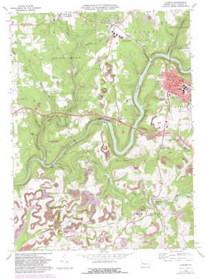
Clarion Topo Map Pennsylvania
To zoom in, hover over the map of Clarion
USGS Topo Quad 41079b4 - 1:24,000 scale
| Topo Map Name: | Clarion |
| USGS Topo Quad ID: | 41079b4 |
| Print Size: | ca. 21 1/4" wide x 27" high |
| Southeast Coordinates: | 41.125° N latitude / 79.375° W longitude |
| Map Center Coordinates: | 41.1875° N latitude / 79.4375° W longitude |
| U.S. State: | PA |
| Filename: | o41079b4.jpg |
| Download Map JPG Image: | Clarion topo map 1:24,000 scale |
| Map Type: | Topographic |
| Topo Series: | 7.5´ |
| Map Scale: | 1:24,000 |
| Source of Map Images: | United States Geological Survey (USGS) |
| Alternate Map Versions: |
Clarion PA 1969, updated 1972 Download PDF Buy paper map Clarion PA 1969, updated 1982 Download PDF Buy paper map Clarion PA 2010 Download PDF Buy paper map Clarion PA 2013 Download PDF Buy paper map Clarion PA 2016 Download PDF Buy paper map |
1:24,000 Topo Quads surrounding Clarion
> Back to 41079a1 at 1:100,000 scale
> Back to 41078a1 at 1:250,000 scale
> Back to U.S. Topo Maps home
Clarion topo map: Gazetteer
Clarion: Airports
Clarion County Airport elevation 444m 1456′Clarion: Dams
Piney Dam elevation 325m 1066′Clarion: Parks
Gemmell Park elevation 461m 1512′State Game Lands Number 63 elevation 373m 1223′
State Game Lands Number 72 elevation 434m 1423′
Clarion: Populated Places
Clarion elevation 462m 1515′Clarion Junction elevation 442m 1450′
Marianne elevation 442m 1450′
Reidsburg elevation 370m 1213′
Shamburg elevation 371m 1217′
Williamsburg elevation 424m 1391′
Clarion: Reservoirs
Piney Reservoir elevation 325m 1066′Clarion: Streams
Boyd Run elevation 332m 1089′Brush Run elevation 340m 1115′
Coal Run elevation 331m 1085′
Courtleys Run elevation 343m 1125′
Deer Creek elevation 304m 997′
Gathers Run elevation 349m 1145′
Paint Creek elevation 352m 1154′
Piney Creek elevation 309m 1013′
Rapp Run elevation 344m 1128′
Reids Run elevation 353m 1158′
Toby Creek elevation 332m 1089′
Trout Run elevation 346m 1135′
Clarion: Summits
Groce Hill elevation 466m 1528′Clarion digital topo map on disk
Buy this Clarion topo map showing relief, roads, GPS coordinates and other geographical features, as a high-resolution digital map file on DVD:


