Polk Topo Map Pennsylvania
To zoom in, hover over the map of Polk
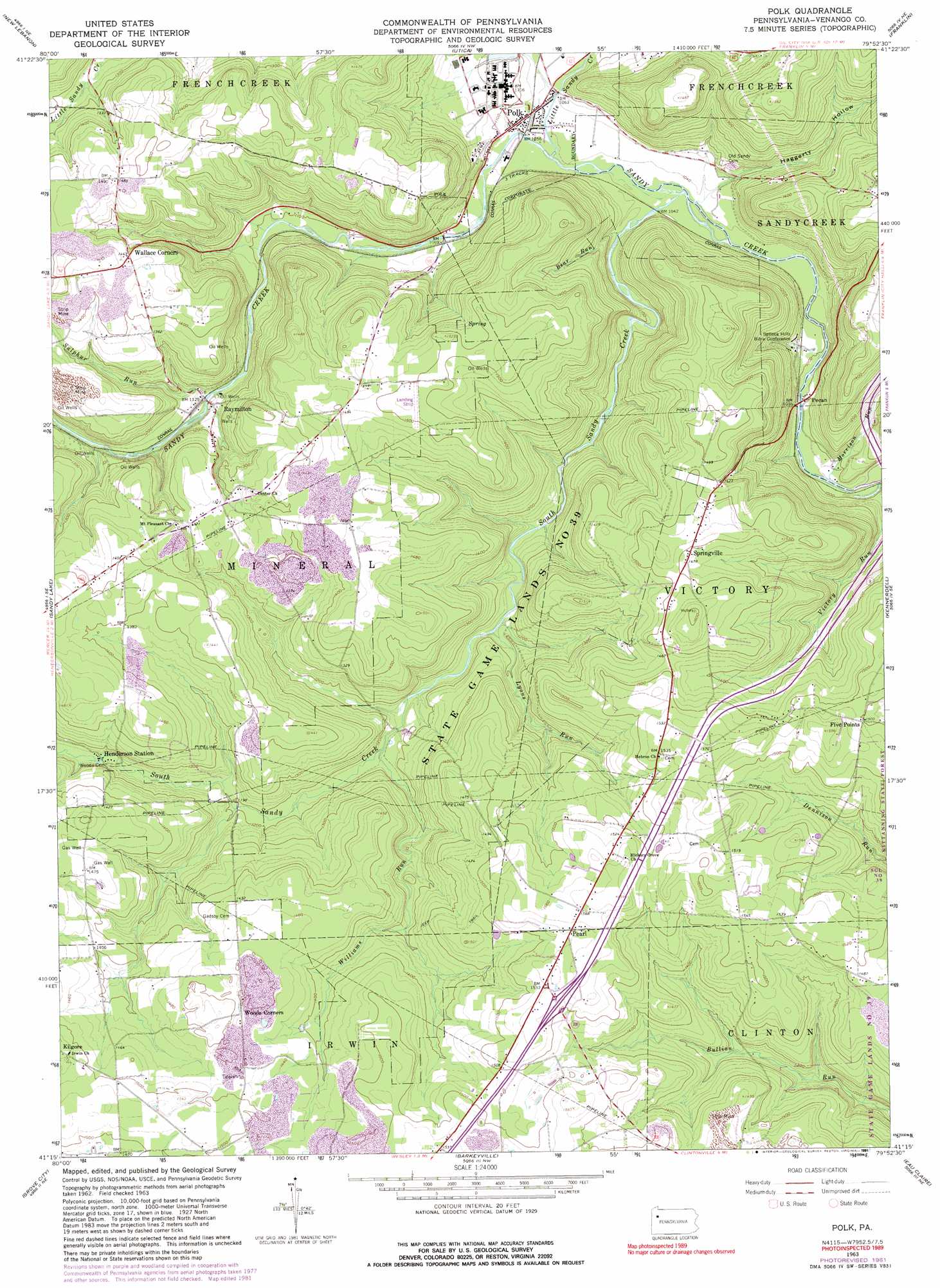
USGS Topo Quad 41079c8 - 1:24,000 scale
| Topo Map Name: | Polk |
| USGS Topo Quad ID: | 41079c8 |
| Print Size: | ca. 21 1/4" wide x 27" high |
| Southeast Coordinates: | 41.25° N latitude / 79.875° W longitude |
| Map Center Coordinates: | 41.3125° N latitude / 79.9375° W longitude |
| U.S. State: | PA |
| Filename: | o41079c8.jpg |
| Download Map JPG Image: | Polk topo map 1:24,000 scale |
| Map Type: | Topographic |
| Topo Series: | 7.5´ |
| Map Scale: | 1:24,000 |
| Source of Map Images: | United States Geological Survey (USGS) |
| Alternate Map Versions: |
Polk PA 1963, updated 1965 Download PDF Buy paper map Polk PA 1963, updated 1973 Download PDF Buy paper map Polk PA 1963, updated 1982 Download PDF Buy paper map Polk PA 1963, updated 1991 Download PDF Buy paper map Polk PA 1963, updated 1991 Download PDF Buy paper map Polk PA 2010 Download PDF Buy paper map Polk PA 2013 Download PDF Buy paper map Polk PA 2016 Download PDF Buy paper map |
1:24,000 Topo Quads surrounding Polk
Geneva |
Cochranton |
Sugar Lake |
Dempseytown |
Titusville South |
Hadley |
New Lebanon |
Utica |
Franklin |
Oil City |
Jackson Center |
Sandy Lake |
Polk |
Kennerdell |
Cranberry |
Mercer |
Grove City |
Barkeyville |
Eau Claire |
Emlenton |
Harlansburg |
Slippery Rock |
West Sunbury |
Hilliards |
Parker |
> Back to 41079a1 at 1:100,000 scale
> Back to 41078a1 at 1:250,000 scale
> Back to U.S. Topo Maps home
Polk topo map: Gazetteer
Polk: Airports
Summer Range Airport elevation 469m 1538′Polk: Bridges
Waterloo Bridge elevation 324m 1062′Polk: Parks
State Game Lands Number 39 elevation 377m 1236′Polk: Populated Places
Five Points elevation 456m 1496′Henderson Station elevation 384m 1259′
Mount Pleasant elevation 409m 1341′
Pearl elevation 474m 1555′
Pecan elevation 317m 1040′
Polk elevation 322m 1056′
Raymilton elevation 343m 1125′
Wallace Corners elevation 445m 1459′
Polk: Post Offices
Polk Post Office (historical) elevation 320m 1049′Polk: Streams
Bear Run elevation 324m 1062′Little Sandy Creek elevation 321m 1053′
Lyons Run elevation 358m 1174′
Morrison Run elevation 305m 1000′
South Sandy Creek elevation 315m 1033′
Sulphur Run elevation 343m 1125′
Williams Run elevation 353m 1158′
Polk: Valleys
Haggerty Hollow elevation 324m 1062′Polk digital topo map on disk
Buy this Polk topo map showing relief, roads, GPS coordinates and other geographical features, as a high-resolution digital map file on DVD:
 map DVD")