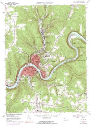
Oil City Topo Map Pennsylvania
To zoom in, hover over the map of Oil City
USGS Topo Quad 41079d6 - 1:24,000 scale
| Topo Map Name: | Oil City |
| USGS Topo Quad ID: | 41079d6 |
| Print Size: | ca. 21 1/4" wide x 27" high |
| Southeast Coordinates: | 41.375° N latitude / 79.625° W longitude |
| Map Center Coordinates: | 41.4375° N latitude / 79.6875° W longitude |
| U.S. State: | PA |
| Filename: | o41079d6.jpg |
| Download Map JPG Image: | Oil City topo map 1:24,000 scale |
| Map Type: | Topographic |
| Topo Series: | 7.5´ |
| Map Scale: | 1:24,000 |
| Source of Map Images: | United States Geological Survey (USGS) |
| Alternate Map Versions: |
Oil City PA 1963, updated 1964 Download PDF Buy paper map Oil City PA 1963, updated 1973 Download PDF Buy paper map Oil City PA 1963, updated 1977 Download PDF Buy paper map Oil City PA 2010 Download PDF Buy paper map Oil City PA 2013 Download PDF Buy paper map Oil City PA 2016 Download PDF Buy paper map |
1:24,000 Topo Quads surrounding Oil City
> Back to 41079a1 at 1:100,000 scale
> Back to 41078a1 at 1:250,000 scale
> Back to U.S. Topo Maps home
Oil City topo map: Gazetteer
Oil City: Airports
Darvassy Airport elevation 427m 1400′Oil City: Bends
Walnut Bend elevation 316m 1036′Oil City: Islands
Alcorn Island elevation 304m 997′Oil City: Populated Places
Ahrensville elevation 333m 1092′Colonial Village elevation 455m 1492′
Fosters Corner elevation 475m 1558′
Grandview elevation 467m 1532′
Hasson Heights elevation 453m 1486′
McClintock elevation 306m 1003′
Oil City elevation 312m 1023′
Oliver Manor elevation 457m 1499′
Plumer elevation 402m 1318′
Rockmere elevation 316m 1036′
Rose Gardens elevation 421m 1381′
Rouseville elevation 316m 1036′
Rynd Farm elevation 311m 1020′
Seneca elevation 443m 1453′
Siverly elevation 313m 1026′
Stanleys Corner elevation 452m 1482′
Tippery elevation 451m 1479′
Woodland Heights elevation 430m 1410′
Oil City: Streams
Calaboose Run elevation 338m 1108′Carney Run elevation 299m 980′
Charley Run elevation 299m 980′
Cherry Run elevation 312m 1023′
Cherrytree Run elevation 317m 1040′
Cornplanter Run elevation 304m 997′
Holiday Run elevation 354m 1161′
Horse Creek elevation 307m 1007′
Lamb Run elevation 299m 980′
Oil Creek elevation 299m 980′
Panther Run elevation 315m 1033′
Sage Run elevation 299m 980′
Slate Run elevation 339m 1112′
Wolf Branch elevation 372m 1220′
Wykle Run elevation 331m 1085′
Oil City: Summits
Foster Hill elevation 484m 1587′Hoag Hill elevation 460m 1509′
Oil City digital topo map on disk
Buy this Oil City topo map showing relief, roads, GPS coordinates and other geographical features, as a high-resolution digital map file on DVD:


