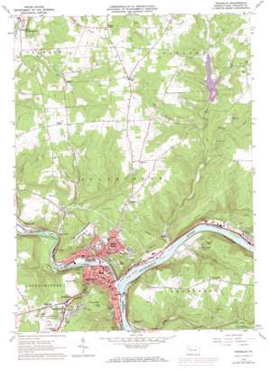
Franklin Topo Map Pennsylvania
To zoom in, hover over the map of Franklin
USGS Topo Quad 41079d7 - 1:24,000 scale
| Topo Map Name: | Franklin |
| USGS Topo Quad ID: | 41079d7 |
| Print Size: | ca. 21 1/4" wide x 27" high |
| Southeast Coordinates: | 41.375° N latitude / 79.75° W longitude |
| Map Center Coordinates: | 41.4375° N latitude / 79.8125° W longitude |
| U.S. State: | PA |
| Filename: | o41079d7.jpg |
| Download Map JPG Image: | Franklin topo map 1:24,000 scale |
| Map Type: | Topographic |
| Topo Series: | 7.5´ |
| Map Scale: | 1:24,000 |
| Source of Map Images: | United States Geological Survey (USGS) |
| Alternate Map Versions: |
Franklin PA 1963, updated 1964 Download PDF Buy paper map Franklin PA 1963, updated 1973 Download PDF Buy paper map Franklin PA 2010 Download PDF Buy paper map Franklin PA 2013 Download PDF Buy paper map Franklin PA 2016 Download PDF Buy paper map |
1:24,000 Topo Quads surrounding Franklin
> Back to 41079a1 at 1:100,000 scale
> Back to 41078a1 at 1:250,000 scale
> Back to U.S. Topo Maps home
Franklin topo map: Gazetteer
Franklin: Airports
Chess-Lamberton Airport elevation 468m 1535′Fisher Airport elevation 457m 1499′
Franklin Hospital Airport elevation 441m 1446′
Hill Top Airport elevation 413m 1354′
Franklin: Dams
Two Mile Run Dam elevation 367m 1204′Franklin: Islands
Hoge Island elevation 299m 980′Franklin: Parks
Miller-Sibley Field elevation 343m 1125′Twomile Run County Park elevation 381m 1250′
Franklin: Populated Places
Bleakley Hill elevation 356m 1167′Bredinsburg elevation 450m 1476′
Cooperstown elevation 341m 1118′
Foster Corner elevation 306m 1003′
Franklin elevation 308m 1010′
Galena Hill elevation 411m 1348′
Galloway elevation 444m 1456′
Gurney Hill elevation 442m 1450′
Haslets Corner elevation 448m 1469′
Mapledale elevation 450m 1476′
Mason elevation 370m 1213′
Oak Hill elevation 428m 1404′
Point Hill elevation 421m 1381′
Reno elevation 310m 1017′
Rocky Grove elevation 305m 1000′
Uniontown elevation 423m 1387′
Franklin: Reservoirs
Reno Reservoir elevation 372m 1220′Two Mile Run Reservoir elevation 367m 1204′
Franklin: Streams
Brannon Run elevation 302m 990′French Creek elevation 292m 958′
French Creek elevation 292m 958′
Lake Creek elevation 346m 1135′
Patchel Run elevation 304m 997′
Read Run elevation 341m 1118′
Seneca Run elevation 300m 984′
Twomile Run elevation 292m 958′
West Branch Twomile Run elevation 347m 1138′
Franklin digital topo map on disk
Buy this Franklin topo map showing relief, roads, GPS coordinates and other geographical features, as a high-resolution digital map file on DVD:


