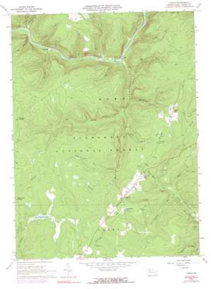
Lynch Topo Map Pennsylvania
To zoom in, hover over the map of Lynch
USGS Topo Quad 41079e1 - 1:24,000 scale
| Topo Map Name: | Lynch |
| USGS Topo Quad ID: | 41079e1 |
| Print Size: | ca. 21 1/4" wide x 27" high |
| Southeast Coordinates: | 41.5° N latitude / 79° W longitude |
| Map Center Coordinates: | 41.5625° N latitude / 79.0625° W longitude |
| U.S. State: | PA |
| Filename: | o41079e1.jpg |
| Download Map JPG Image: | Lynch topo map 1:24,000 scale |
| Map Type: | Topographic |
| Topo Series: | 7.5´ |
| Map Scale: | 1:24,000 |
| Source of Map Images: | United States Geological Survey (USGS) |
| Alternate Map Versions: |
Lynch PA 1966, updated 1968 Download PDF Buy paper map Lynch PA 1966, updated 1973 Download PDF Buy paper map Lynch PA 1966, updated 1990 Download PDF Buy paper map Lynch PA 2011 Download PDF Buy paper map Lynch PA 2013 Download PDF Buy paper map Lynch PA 2016 Download PDF Buy paper map |
| FStopo: | US Forest Service topo Lynch is available: Download FStopo PDF Download FStopo TIF |
1:24,000 Topo Quads surrounding Lynch
> Back to 41079e1 at 1:100,000 scale
> Back to 41078a1 at 1:250,000 scale
> Back to U.S. Topo Maps home
Lynch topo map: Gazetteer
Lynch: Dams
Beaver Meadows Dam elevation 510m 1673′Lynch: Populated Places
Byromtown elevation 556m 1824′Hastings elevation 378m 1240′
Iron City elevation 533m 1748′
Lynch elevation 388m 1272′
Penoke elevation 550m 1804′
Pigeon elevation 536m 1758′
Lynch: Reservoirs
Beaver Meadows Lake elevation 506m 1660′Lynch: Streams
Bald Hill Run elevation 389m 1276′Bluejay Creek elevation 383m 1256′
Bush Creek elevation 382m 1253′
Gilfoyle Run elevation 445m 1459′
Hastings Run elevation 372m 1220′
Lower Sheriff Run elevation 372m 1220′
Martin Run elevation 378m 1240′
Penoke Run elevation 510m 1673′
Rappe Run elevation 447m 1466′
Reagan Run elevation 378m 1240′
Rock Run elevation 454m 1489′
Rock Spring Run elevation 426m 1397′
Rocky Run elevation 378m 1240′
Slater Run elevation 411m 1348′
Straight Run elevation 431m 1414′
Thad Shanty Run elevation 382m 1253′
Upper Sheriff Run elevation 375m 1230′
Watson Branch elevation 445m 1459′
Watsontown Run elevation 406m 1332′
West Branch Bluejay Creek elevation 412m 1351′
Lynch: Summits
Bald Hill elevation 544m 1784′Lynch: Valleys
Lindsey Hollow elevation 381m 1250′Lynch digital topo map on disk
Buy this Lynch topo map showing relief, roads, GPS coordinates and other geographical features, as a high-resolution digital map file on DVD:


