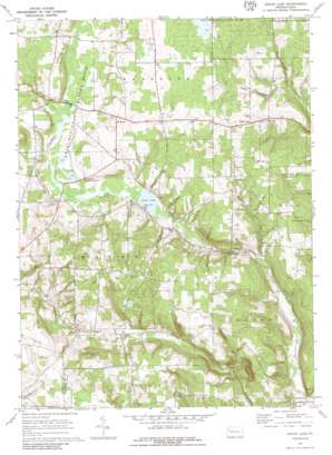
Sugar Lake Topo Map Pennsylvania
To zoom in, hover over the map of Sugar Lake
USGS Topo Quad 41079e8 - 1:24,000 scale
| Topo Map Name: | Sugar Lake |
| USGS Topo Quad ID: | 41079e8 |
| Print Size: | ca. 21 1/4" wide x 27" high |
| Southeast Coordinates: | 41.5° N latitude / 79.875° W longitude |
| Map Center Coordinates: | 41.5625° N latitude / 79.9375° W longitude |
| U.S. State: | PA |
| Filename: | o41079e8.jpg |
| Download Map JPG Image: | Sugar Lake topo map 1:24,000 scale |
| Map Type: | Topographic |
| Topo Series: | 7.5´ |
| Map Scale: | 1:24,000 |
| Source of Map Images: | United States Geological Survey (USGS) |
| Alternate Map Versions: |
Sugar Lake PA 1967, updated 1972 Download PDF Buy paper map Sugar Lake PA 1967, updated 1986 Download PDF Buy paper map Sugar Lake PA 2010 Download PDF Buy paper map Sugar Lake PA 2013 Download PDF Buy paper map Sugar Lake PA 2016 Download PDF Buy paper map |
1:24,000 Topo Quads surrounding Sugar Lake
> Back to 41079e1 at 1:100,000 scale
> Back to 41078a1 at 1:250,000 scale
> Back to U.S. Topo Maps home
Sugar Lake topo map: Gazetteer
Sugar Lake: Airports
Maple Cave Park Airport elevation 353m 1158′Sugar Lake: Dams
Erie NWR Pool Number Nine elevation 398m 1305′Erie NWR Pool Number Seven elevation 396m 1299′
Little Sugar Creek Dam elevation 467m 1532′
Sugar Lake: Lakes
Sugar Lake elevation 392m 1286′Sugar Lake: Parks
Erie National Wildlife Refuge elevation 405m 1328′Sugar Lake: Populated Places
Black Ash elevation 474m 1555′Deckard elevation 381m 1250′
East Wayne elevation 464m 1522′
Mount Hope elevation 439m 1440′
Wilson Mills elevation 397m 1302′
Sugar Lake: Ridges
Dead-Ice Terminal Moraine elevation 451m 1479′Sugar Lake: Streams
Brawley Run elevation 398m 1305′Little Sugar Creek elevation 418m 1371′
McCauley Run elevation 388m 1272′
Trout Run elevation 382m 1253′
Sugar Lake digital topo map on disk
Buy this Sugar Lake topo map showing relief, roads, GPS coordinates and other geographical features, as a high-resolution digital map file on DVD:


