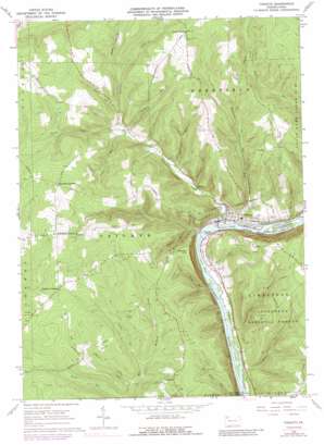
Tidioute Topo Map Pennsylvania
To zoom in, hover over the map of Tidioute
USGS Topo Quad 41079f4 - 1:24,000 scale
| Topo Map Name: | Tidioute |
| USGS Topo Quad ID: | 41079f4 |
| Print Size: | ca. 21 1/4" wide x 27" high |
| Southeast Coordinates: | 41.625° N latitude / 79.375° W longitude |
| Map Center Coordinates: | 41.6875° N latitude / 79.4375° W longitude |
| U.S. State: | PA |
| Filename: | o41079f4.jpg |
| Download Map JPG Image: | Tidioute topo map 1:24,000 scale |
| Map Type: | Topographic |
| Topo Series: | 7.5´ |
| Map Scale: | 1:24,000 |
| Source of Map Images: | United States Geological Survey (USGS) |
| Alternate Map Versions: |
Tidioute PA 1966, updated 1968 Download PDF Buy paper map Tidioute PA 1966, updated 1973 Download PDF Buy paper map Tidioute PA 1966, updated 1984 Download PDF Buy paper map Tidioute PA 1966, updated 1989 Download PDF Buy paper map Tidioute PA 2011 Download PDF Buy paper map Tidioute PA 2013 Download PDF Buy paper map Tidioute PA 2016 Download PDF Buy paper map |
| FStopo: | US Forest Service topo Tidioute is available: Download FStopo PDF Download FStopo TIF |
1:24,000 Topo Quads surrounding Tidioute
> Back to 41079e1 at 1:100,000 scale
> Back to 41078a1 at 1:250,000 scale
> Back to U.S. Topo Maps home
Tidioute topo map: Gazetteer
Tidioute: Bays
Courson Eddy elevation 329m 1079′Lower Eddy elevation 329m 1079′
Tidioute Eddy elevation 329m 1079′
Tidioute: Islands
Courson Island elevation 336m 1102′McGuire Island elevation 329m 1079′
Siggias Island elevation 330m 1082′
Tidioute Island elevation 330m 1082′
Tidioute: Populated Places
Excelsior Corner elevation 520m 1706′Fagundus elevation 504m 1653′
Tidioute elevation 343m 1125′
Triumph elevation 514m 1686′
Tidioute: Streams
Cochener Run elevation 363m 1190′Dale Run elevation 329m 1079′
Dennis Run elevation 344m 1128′
Dunn Run elevation 326m 1069′
Fuellhart Run elevation 355m 1164′
George Run elevation 388m 1272′
Gilmore Run elevation 382m 1253′
Gordon Run elevation 335m 1099′
Grove Run elevation 336m 1102′
Jones Run elevation 395m 1295′
Lamb Run elevation 419m 1374′
Martin Run elevation 410m 1345′
McGuire Run elevation 335m 1099′
Myers Run elevation 330m 1082′
Pedler Run elevation 382m 1253′
Potter Run elevation 342m 1122′
Rock Hollow Run elevation 419m 1374′
Tidioute Creek elevation 329m 1079′
Tidioute: Summits
Babylon Hill elevation 495m 1624′Tidioute: Valleys
Rock Hollow elevation 420m 1377′Tidioute digital topo map on disk
Buy this Tidioute topo map showing relief, roads, GPS coordinates and other geographical features, as a high-resolution digital map file on DVD:


