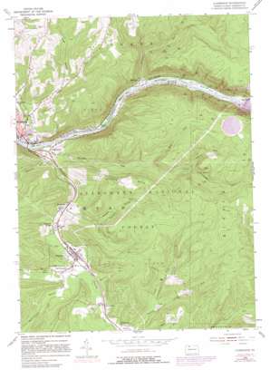
Clarendon Topo Map Pennsylvania
To zoom in, hover over the map of Clarendon
USGS Topo Quad 41079g1 - 1:24,000 scale
| Topo Map Name: | Clarendon |
| USGS Topo Quad ID: | 41079g1 |
| Print Size: | ca. 21 1/4" wide x 27" high |
| Southeast Coordinates: | 41.75° N latitude / 79° W longitude |
| Map Center Coordinates: | 41.8125° N latitude / 79.0625° W longitude |
| U.S. State: | PA |
| Filename: | o41079g1.jpg |
| Download Map JPG Image: | Clarendon topo map 1:24,000 scale |
| Map Type: | Topographic |
| Topo Series: | 7.5´ |
| Map Scale: | 1:24,000 |
| Source of Map Images: | United States Geological Survey (USGS) |
| Alternate Map Versions: |
Clarendon PA 1954, updated 1956 Download PDF Buy paper map Clarendon PA 1954, updated 1966 Download PDF Buy paper map Clarendon PA 1954, updated 1973 Download PDF Buy paper map Clarendon PA 1954, updated 1981 Download PDF Buy paper map Clarendon PA 1954, updated 1981 Download PDF Buy paper map Clarendon PA 2011 Download PDF Buy paper map Clarendon PA 2013 Download PDF Buy paper map Clarendon PA 2016 Download PDF Buy paper map |
| FStopo: | US Forest Service topo Clarendon is available: Download FStopo PDF Download FStopo TIF |
1:24,000 Topo Quads surrounding Clarendon
> Back to 41079e1 at 1:100,000 scale
> Back to 41078a1 at 1:250,000 scale
> Back to U.S. Topo Maps home
Clarendon topo map: Gazetteer
Clarendon: Dams
Kinzua Dam elevation 405m 1328′Kinzua Pumped Storage Dam elevation 633m 2076′
Clarendon: Islands
Dixon Island elevation 368m 1207′Harmon Island elevation 366m 1200′
Knight Island elevation 356m 1167′
Verbeck Island elevation 366m 1200′
Wardwell Island elevation 365m 1197′
Clarendon: Populated Places
Big Bend elevation 377m 1236′Clarendon elevation 427m 1400′
Clarendon Heights elevation 428m 1404′
Glade elevation 365m 1197′
Hemlock elevation 369m 1210′
Old Clarendon elevation 430m 1410′
Rogertown elevation 372m 1220′
Shipmans Eddy elevation 367m 1204′
Stoneham elevation 406m 1332′
Weldbank elevation 426m 1397′
Clarendon: Post Offices
North Clarendon Post Office (historical) elevation 429m 1407′Weldbank Post Office (historical) elevation 426m 1397′
Clarendon: Reservoirs
Allegheny Reservoir elevation 405m 1328′Kinzua Pumped Storage Reservoir elevation 633m 2076′
Seneca Pumped Storage Area elevation 633m 2076′
Clarendon: Streams
Anderson Run elevation 362m 1187′Arnot Run elevation 414m 1358′
Browns Run elevation 360m 1181′
Dutchman Run elevation 365m 1197′
Farnsworth Branch elevation 417m 1368′
Fluent Run elevation 481m 1578′
Glade Run elevation 356m 1167′
Hemlock Run elevation 366m 1200′
Hook Run elevation 452m 1482′
Morrison Run elevation 363m 1190′
North Fork Sixmile Run elevation 431m 1414′
Pacard Run elevation 418m 1371′
Possum Run elevation 422m 1384′
Ward Run elevation 362m 1187′
Wolf Run elevation 420m 1377′
Clarendon: Summits
Stone Hill elevation 594m 1948′Clarendon: Swamps
Cranberry Swamp elevation 417m 1368′Clarendon: Valleys
Page Hollow elevation 422m 1384′Possum Hollow elevation 407m 1335′
Clarendon digital topo map on disk
Buy this Clarendon topo map showing relief, roads, GPS coordinates and other geographical features, as a high-resolution digital map file on DVD:


