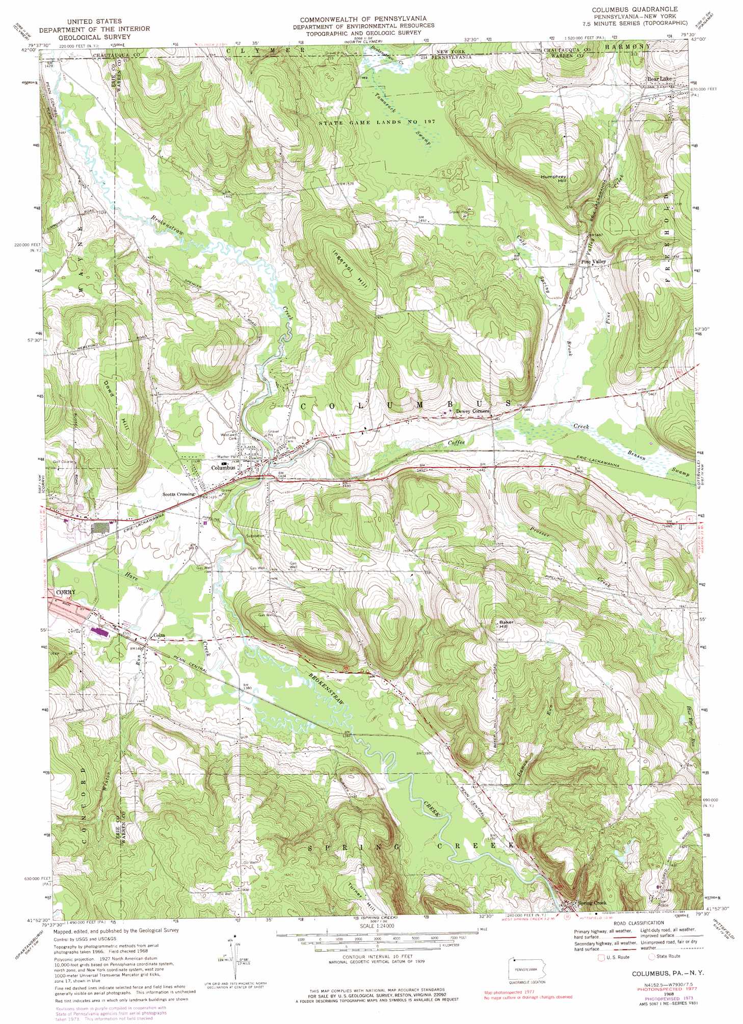
Columbus Topo Map Pennsylvania
To zoom in, hover over the map of Columbus
USGS Topo Quad 41079h5 - 1:24,000 scale
| Topo Map Name: | Columbus |
| USGS Topo Quad ID: | 41079h5 |
| Print Size: | ca. 21 1/4" wide x 27" high |
| Southeast Coordinates: | 41.875° N latitude / 79.5° W longitude |
| Map Center Coordinates: | 41.9375° N latitude / 79.5625° W longitude |
| U.S. States: | PA, NY |
| Filename: | o41079h5.jpg |
| Download Map JPG Image: | Columbus topo map 1:24,000 scale |
| Map Type: | Topographic |
| Topo Series: | 7.5´ |
| Map Scale: | 1:24,000 |
| Source of Map Images: | United States Geological Survey (USGS) |
| Alternate Map Versions: |
Columbus PA 1968, updated 1971 Download PDF Buy paper map Columbus PA 1968, updated 1975 Download PDF Buy paper map Columbus PA 1968, updated 1983 Download PDF Buy paper map Columbus PA 1968, updated 1991 Download PDF Buy paper map Columbus PA 2010 Download PDF Buy paper map Columbus PA 2013 Download PDF Buy paper map Columbus PA 2016 Download PDF Buy paper map |
1:24,000 Topo Quads surrounding Columbus
North East |
South Ripley |
Sherman |
Chautauqua |
Ellery Center |
Wattsburg |
Clymer |
North Clymer |
Panama |
Lakewood |
Union City |
Corry |
Columbus |
Lottsville |
Sugar Grove |
Lake Canadohta |
Spartansburg |
Spring Creek |
Pittsfield |
Youngsville |
Centerville |
Titusville North |
Grand Valley |
Tidioute |
Cobham |
> Back to 41079e1 at 1:100,000 scale
> Back to 41078a1 at 1:250,000 scale
> Back to U.S. Topo Maps home
Columbus topo map: Gazetteer
Columbus: Parks
Mather Park elevation 440m 1443′State Game Lands Number 197 elevation 446m 1463′
State Game Lands Number 263 elevation 484m 1587′
State Game Lands Number 291 elevation 537m 1761′
State Game Lands Number 306 elevation 437m 1433′
Columbus: Populated Places
Bear Lake elevation 474m 1555′Columbus elevation 427m 1400′
Colza elevation 426m 1397′
Pine Valley elevation 444m 1456′
Scotts Crossing elevation 435m 1427′
Spring Creek elevation 428m 1404′
Columbus: Springs
Sulfur Spring elevation 454m 1489′Columbus: Streams
Coffee Creek elevation 426m 1397′Cold Spring Brook elevation 435m 1427′
Damon Run elevation 417m 1368′
Hare Creek elevation 420m 1377′
Hare Creek elevation 420m 1377′
Pine Valley Creek elevation 436m 1430′
Prosser Creek elevation 434m 1423′
Winton Run elevation 424m 1391′
Columbus: Summits
Baker Hill elevation 572m 1876′Dowd Hill elevation 528m 1732′
Humphrey Hill elevation 534m 1751′
Ingersol Hill elevation 533m 1748′
Turner Hill elevation 559m 1833′
Columbus: Swamps
Benson Swamp elevation 437m 1433′Tamarack Swamp elevation 446m 1463′
Columbus digital topo map on disk
Buy this Columbus topo map showing relief, roads, GPS coordinates and other geographical features, as a high-resolution digital map file on DVD:
 map DVD")