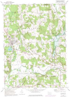
Waterford Topo Map Pennsylvania
To zoom in, hover over the map of Waterford
USGS Topo Quad 41079h8 - 1:24,000 scale
| Topo Map Name: | Waterford |
| USGS Topo Quad ID: | 41079h8 |
| Print Size: | ca. 21 1/4" wide x 27" high |
| Southeast Coordinates: | 41.875° N latitude / 79.875° W longitude |
| Map Center Coordinates: | 41.9375° N latitude / 79.9375° W longitude |
| U.S. State: | PA |
| Filename: | o41079h8.jpg |
| Download Map JPG Image: | Waterford topo map 1:24,000 scale |
| Map Type: | Topographic |
| Topo Series: | 7.5´ |
| Map Scale: | 1:24,000 |
| Source of Map Images: | United States Geological Survey (USGS) |
| Alternate Map Versions: |
Waterford PA 1967, updated 1973 Download PDF Buy paper map Waterford PA 1967, updated 1976 Download PDF Buy paper map Waterford PA 1967, updated 1976 Download PDF Buy paper map Waterford PA 2010 Download PDF Buy paper map Waterford PA 2013 Download PDF Buy paper map Waterford PA 2016 Download PDF Buy paper map |
1:24,000 Topo Quads surrounding Waterford
> Back to 41079e1 at 1:100,000 scale
> Back to 41078a1 at 1:250,000 scale
> Back to U.S. Topo Maps home
Waterford topo map: Gazetteer
Waterford: Dams
Union City Dam elevation 390m 1279′Waterford: Lakes
LeBoeuf Lake elevation 355m 1164′Waterford: Parks
State Game Lands Number 109 elevation 371m 1217′State Game Lands Number 190 elevation 403m 1322′
Waterford: Populated Places
Indian Head elevation 392m 1286′LeBoeuf Garden elevation 359m 1177′
Mill Village elevation 367m 1204′
New Ireland elevation 395m 1295′
Valley Corners elevation 403m 1322′
Waterford elevation 367m 1204′
Waterford: Reservoirs
Union City Lake elevation 369m 1210′Waterford: Streams
Benson Run elevation 366m 1200′East Branch LeBoeuf Creek elevation 371m 1217′
Honey Bee Creek elevation 357m 1171′
Horton Run elevation 369m 1210′
LeBoeuf Creek elevation 353m 1158′
South Branch French Creek elevation 365m 1197′
Trout Run elevation 355m 1164′
Wheeler Creek elevation 360m 1181′
Waterford: Summits
Oak Hill elevation 433m 1420′Waterford digital topo map on disk
Buy this Waterford topo map showing relief, roads, GPS coordinates and other geographical features, as a high-resolution digital map file on DVD:


