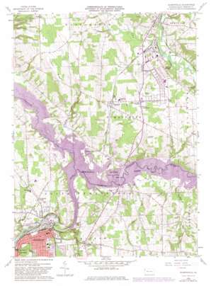
Sharpsville Topo Map Pennsylvania
To zoom in, hover over the map of Sharpsville
USGS Topo Quad 41080c4 - 1:24,000 scale
| Topo Map Name: | Sharpsville |
| USGS Topo Quad ID: | 41080c4 |
| Print Size: | ca. 21 1/4" wide x 27" high |
| Southeast Coordinates: | 41.25° N latitude / 80.375° W longitude |
| Map Center Coordinates: | 41.3125° N latitude / 80.4375° W longitude |
| U.S. State: | PA |
| Filename: | o41080c4.jpg |
| Download Map JPG Image: | Sharpsville topo map 1:24,000 scale |
| Map Type: | Topographic |
| Topo Series: | 7.5´ |
| Map Scale: | 1:24,000 |
| Source of Map Images: | United States Geological Survey (USGS) |
| Alternate Map Versions: |
Sharpsville PA 1958, updated 1959 Download PDF Buy paper map Sharpsville PA 1958, updated 1972 Download PDF Buy paper map Sharpsville PA 1958, updated 1982 Download PDF Buy paper map Sharpsville PA 1958, updated 1984 Download PDF Buy paper map Sharpsville PA 1958, updated 1984 Download PDF Buy paper map Sharpsville PA 2010 Download PDF Buy paper map Sharpsville PA 2013 Download PDF Buy paper map Sharpsville PA 2016 Download PDF Buy paper map |
1:24,000 Topo Quads surrounding Sharpsville
> Back to 41080a1 at 1:100,000 scale
> Back to 41080a1 at 1:250,000 scale
> Back to U.S. Topo Maps home
Sharpsville topo map: Gazetteer
Sharpsville: Airports
Napodano Airport elevation 335m 1099′Sharpsville: Dams
Shenango River Dam elevation 282m 925′Sharpsville: Parks
Mahaney Public Use Area elevation 283m 928′Shenango Public Use Area elevation 273m 895′
Sharpsville: Populated Places
Clark elevation 273m 895′Greencrest Park elevation 324m 1062′
Lamonts Corners elevation 311m 1020′
Pritchards Corner elevation 301m 987′
Reynolds Heights elevation 327m 1072′
Sharpsville elevation 314m 1030′
Transfer elevation 307m 1007′
Sharpsville: Reservoirs
Shenango River Lake elevation 276m 905′Shenango River Lake elevation 276m 905′
Sharpsville: Ridges
Prospect Ridge elevation 389m 1276′Sharpsville: Streams
Big Run elevation 289m 948′Brush Run elevation 283m 928′
Chestnut Run elevation 274m 898′
Golden Run elevation 277m 908′
Magargee Run elevation 276m 905′
McCullough Run elevation 265m 869′
McCullough Run elevation 265m 869′
Pine Hollow Run elevation 284m 931′
Pymatuning Creek elevation 273m 895′
Sharpsville digital topo map on disk
Buy this Sharpsville topo map showing relief, roads, GPS coordinates and other geographical features, as a high-resolution digital map file on DVD:


