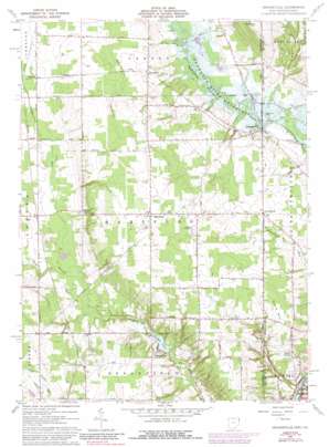
Orangeville Topo Map Ohio
To zoom in, hover over the map of Orangeville
USGS Topo Quad 41080c5 - 1:24,000 scale
| Topo Map Name: | Orangeville |
| USGS Topo Quad ID: | 41080c5 |
| Print Size: | ca. 21 1/4" wide x 27" high |
| Southeast Coordinates: | 41.25° N latitude / 80.5° W longitude |
| Map Center Coordinates: | 41.3125° N latitude / 80.5625° W longitude |
| U.S. States: | OH, PA |
| Filename: | o41080c5.jpg |
| Download Map JPG Image: | Orangeville topo map 1:24,000 scale |
| Map Type: | Topographic |
| Topo Series: | 7.5´ |
| Map Scale: | 1:24,000 |
| Source of Map Images: | United States Geological Survey (USGS) |
| Alternate Map Versions: |
Orangeville OH 1961, updated 1963 Download PDF Buy paper map Orangeville OH 1961, updated 1975 Download PDF Buy paper map Orangeville OH 1961, updated 1980 Download PDF Buy paper map Orangeville OH 1961, updated 1988 Download PDF Buy paper map Orangeville OH 1994, updated 1997 Download PDF Buy paper map Orangeville OH 2010 Download PDF Buy paper map Orangeville OH 2013 Download PDF Buy paper map Orangeville OH 2016 Download PDF Buy paper map |
1:24,000 Topo Quads surrounding Orangeville
> Back to 41080a1 at 1:100,000 scale
> Back to 41080a1 at 1:250,000 scale
> Back to U.S. Topo Maps home
Orangeville topo map: Gazetteer
Orangeville: Airports
Kenley Airport elevation 368m 1207′Port Sember Airport elevation 315m 1033′
Orangeville: Capes
Five Points elevation 317m 1040′Orangeville: Dams
Yankee Lake Dam elevation 285m 935′Orangeville: Populated Places
Antietam (historical) elevation 330m 1082′Brockway (historical) elevation 321m 1053′
Burghill elevation 314m 1030′
Five Points elevation 317m 1040′
Hartford elevation 357m 1171′
Latimer elevation 311m 1020′
Orangeville elevation 280m 918′
Weldon elevation 353m 1158′
Yankee Lake elevation 307m 1007′
Orangeville: Post Offices
Antietam Post Office (historical) elevation 330m 1082′Brockway Post Office (historical) elevation 329m 1079′
Burghill Post Office elevation 313m 1026′
Hartford Post Office elevation 356m 1167′
Latimer Post Office (historical) elevation 310m 1017′
Orangeville Post Office elevation 281m 921′
Weldon Post Office (historical) elevation 353m 1158′
Orangeville: Reservoirs
Yankee Lake elevation 285m 935′Orangeville: Streams
Big Run elevation 263m 862′Big Run elevation 263m 862′
Booth Run elevation 274m 898′
South Branch Yankee Run elevation 299m 980′
Thornton Run elevation 265m 869′
Orangeville: Summits
Clark Hill elevation 348m 1141′Trautman Hill elevation 390m 1279′
Orangeville digital topo map on disk
Buy this Orangeville topo map showing relief, roads, GPS coordinates and other geographical features, as a high-resolution digital map file on DVD:


