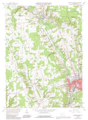
Greenville West Topo Map Pennsylvania
To zoom in, hover over the map of Greenville West
USGS Topo Quad 41080d4 - 1:24,000 scale
| Topo Map Name: | Greenville West |
| USGS Topo Quad ID: | 41080d4 |
| Print Size: | ca. 21 1/4" wide x 27" high |
| Southeast Coordinates: | 41.375° N latitude / 80.375° W longitude |
| Map Center Coordinates: | 41.4375° N latitude / 80.4375° W longitude |
| U.S. State: | PA |
| Filename: | o41080d4.jpg |
| Download Map JPG Image: | Greenville West topo map 1:24,000 scale |
| Map Type: | Topographic |
| Topo Series: | 7.5´ |
| Map Scale: | 1:24,000 |
| Source of Map Images: | United States Geological Survey (USGS) |
| Alternate Map Versions: |
Greensville West PA 1958, updated 1960 Download PDF Buy paper map Greensville West PA 1958, updated 1972 Download PDF Buy paper map Greenville West PA 1958, updated 1988 Download PDF Buy paper map Greenville West PA 1958, updated 1990 Download PDF Buy paper map Greenville West PA 2010 Download PDF Buy paper map Greenville West PA 2013 Download PDF Buy paper map Greenville West PA 2016 Download PDF Buy paper map |
1:24,000 Topo Quads surrounding Greenville West
> Back to 41080a1 at 1:100,000 scale
> Back to 41080a1 at 1:250,000 scale
> Back to U.S. Topo Maps home
Greenville West topo map: Gazetteer
Greenville West: Airports
Greenville Municipal Airport elevation 361m 1184′Holsing Airport elevation 321m 1053′
Greenville West: Dams
Pymatuning Reservoir Dam elevation 305m 1000′Rose Valley Lake Dam elevation 358m 1174′
Greenville West: Populated Places
Donner Crossroads elevation 330m 1082′Greenville elevation 288m 944′
Jamestown elevation 302m 990′
Maysville elevation 315m 1033′
Shenango elevation 298m 977′
Greenville West: Reservoirs
Pymatuning Reservoir elevation 319m 1046′Pymatuning Reservoir elevation 305m 1000′
Greenville West: Streams
Little Shenango River elevation 286m 938′Mathay Run elevation 283m 928′
Saul Run elevation 286m 938′
Sugar Run elevation 299m 980′
Greenville West digital topo map on disk
Buy this Greenville West topo map showing relief, roads, GPS coordinates and other geographical features, as a high-resolution digital map file on DVD:


