Linesville Topo Map Pennsylvania
To zoom in, hover over the map of Linesville
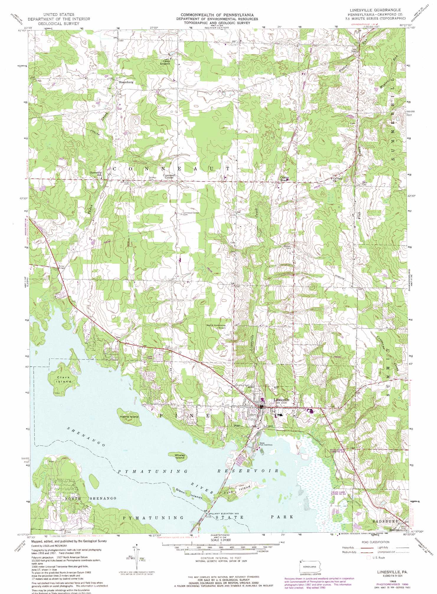
USGS Topo Quad 41080f4 - 1:24,000 scale
| Topo Map Name: | Linesville |
| USGS Topo Quad ID: | 41080f4 |
| Print Size: | ca. 21 1/4" wide x 27" high |
| Southeast Coordinates: | 41.625° N latitude / 80.375° W longitude |
| Map Center Coordinates: | 41.6875° N latitude / 80.4375° W longitude |
| U.S. State: | PA |
| Filename: | o41080f4.jpg |
| Download Map JPG Image: | Linesville topo map 1:24,000 scale |
| Map Type: | Topographic |
| Topo Series: | 7.5´ |
| Map Scale: | 1:24,000 |
| Source of Map Images: | United States Geological Survey (USGS) |
| Alternate Map Versions: |
Linesville PA 1959, updated 1961 Download PDF Buy paper map Linesville PA 1959, updated 1972 Download PDF Buy paper map Linesville PA 1959, updated 1990 Download PDF Buy paper map Linesville PA 2010 Download PDF Buy paper map Linesville PA 2013 Download PDF Buy paper map Linesville PA 2016 Download PDF Buy paper map |
1:24,000 Topo Quads surrounding Linesville
North Kingsville |
Conneaut |
East Springfield |
Albion |
Edinboro North |
Gageville |
Pierpont |
Beaver Center |
Conneautville |
Edinboro South |
Dorset |
Leon |
Linesville |
Harmonsburg |
Meadville |
Cherry Valley |
Andover |
Hartstown |
Conneaut Lake |
Geneva |
Gustavus |
Kinsman |
Greenville West |
Greenville East |
Hadley |
> Back to 41080e1 at 1:100,000 scale
> Back to 41080a1 at 1:250,000 scale
> Back to U.S. Topo Maps home
Linesville topo map: Gazetteer
Linesville: Airports
Merrys Pymatuning Airport elevation 367m 1204′Summers Heliport elevation 336m 1102′
Linesville: Bridges
Finley Bridge elevation 311m 1020′Linesville: Islands
Clark Island elevation 312m 1023′Ford Island elevation 319m 1046′
Glenn Islands elevation 308m 1010′
Harris Island elevation 318m 1043′
Whaley Island elevation 308m 1010′
Linesville: Populated Places
Center Road elevation 348m 1141′Conneaut Center elevation 352m 1154′
Dantown elevation 353m 1158′
Linesville elevation 320m 1049′
Steamburg elevation 330m 1082′
Tuttle Lake elevation 314m 1030′
Waring elevation 311m 1020′
Linesville: Post Offices
Center Road Station Post Office (historical) elevation 349m 1145′Linesville: Streams
Linesville Creek elevation 308m 1010′Paden Creek elevation 307m 1007′
Linesville digital topo map on disk
Buy this Linesville topo map showing relief, roads, GPS coordinates and other geographical features, as a high-resolution digital map file on DVD:
 map DVD")