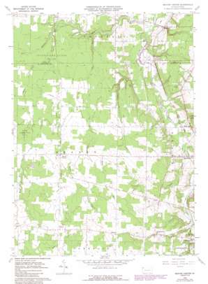
Beaver Center Topo Map Pennsylvania
To zoom in, hover over the map of Beaver Center
USGS Topo Quad 41080g4 - 1:24,000 scale
| Topo Map Name: | Beaver Center |
| USGS Topo Quad ID: | 41080g4 |
| Print Size: | ca. 21 1/4" wide x 27" high |
| Southeast Coordinates: | 41.75° N latitude / 80.375° W longitude |
| Map Center Coordinates: | 41.8125° N latitude / 80.4375° W longitude |
| U.S. State: | PA |
| Filename: | o41080g4.jpg |
| Download Map JPG Image: | Beaver Center topo map 1:24,000 scale |
| Map Type: | Topographic |
| Topo Series: | 7.5´ |
| Map Scale: | 1:24,000 |
| Source of Map Images: | United States Geological Survey (USGS) |
| Alternate Map Versions: |
Beaver Center PA 1959, updated 1960 Download PDF Buy paper map Beaver Center PA 1959, updated 1972 Download PDF Buy paper map Beaver Center PA 1959, updated 1983 Download PDF Buy paper map Beaver Center PA 1959, updated 1990 Download PDF Buy paper map Beaver Center PA 2010 Download PDF Buy paper map Beaver Center PA 2013 Download PDF Buy paper map Beaver Center PA 2016 Download PDF Buy paper map |
1:24,000 Topo Quads surrounding Beaver Center
> Back to 41080e1 at 1:100,000 scale
> Back to 41080a1 at 1:250,000 scale
> Back to U.S. Topo Maps home
Beaver Center topo map: Gazetteer
Beaver Center: Airports
Freeman Airport elevation 290m 951′Pontius Airport elevation 333m 1092′
Beaver Center: Parks
State Game Lands Number 101 elevation 293m 961′Beaver Center: Populated Places
Beaver Center elevation 314m 1030′Conneautville Station elevation 324m 1062′
Keepville elevation 273m 895′
Palmer elevation 344m 1128′
Pennside elevation 278m 912′
Shadeland elevation 290m 951′
Tracy elevation 292m 958′
Beaver Center: Streams
Crazy Run elevation 271m 889′East Branch Conneaut Creek elevation 283m 928′
Middle Branch Conneaut Creek elevation 291m 954′
Mud Run elevation 282m 925′
Stone Run elevation 259m 849′
West Branch Conneaut Creek elevation 258m 846′
Beaver Center digital topo map on disk
Buy this Beaver Center topo map showing relief, roads, GPS coordinates and other geographical features, as a high-resolution digital map file on DVD:


